Löttorp: Difference between revisions
Content deleted Content added
Citation bot (talk | contribs) Alter: template type. | You can use this bot yourself. Report bugs here. | Suggested by AManWithNoPlan | All pages linked from cached copy of User:AManWithNoPlan/sandbox3 | via #UCB_webform_linked |
GreenC bot (talk | contribs) Move 1 url. Wayback Medic 2.5 |
||
| (3 intermediate revisions by 3 users not shown) | |||
| Line 1: | Line 1: | ||
{{Infobox settlement |
{{Infobox settlement |
||
|official_name = Löttorp |
|official_name = Löttorp |
||
|image_skyline = |
|image_skyline = Löttorp 09.jpg |
||
|image_caption = |
|image_caption = |
||
|pushpin_map = Sweden Kalmar#Sweden |
|pushpin_map = Sweden Kalmar#Sweden |
||
| Line 13: | Line 13: | ||
|subdivision_type1 = [[Provinces of Sweden|Province]] |
|subdivision_type1 = [[Provinces of Sweden|Province]] |
||
|subdivision_name1 = [[Öland]] |
|subdivision_name1 = [[Öland]] |
||
|area_footnotes = <ref name=scb>{{cite web|url=http://www.scb.se/Statistik/MI/MI0810/2010A01/Tatorternami0810tab1_4.xls |title=Tätorternas landareal, folkmängd och invånare per km<sup>2</sup> 2005 och 2010 |date=14 December 2011 |publisher=[[Statistics Sweden]] |language=Swedish |archiveurl=https:// |
|area_footnotes = <ref name=scb>{{cite web|url=http://www.scb.se/Statistik/MI/MI0810/2010A01/Tatorternami0810tab1_4.xls |title=Tätorternas landareal, folkmängd och invånare per km<sup>2</sup> 2005 och 2010 |date=14 December 2011 |publisher=[[Statistics Sweden]] |language=Swedish |archiveurl=https://web.archive.org/web/20120127055525/http://www.scb.se/Statistik/MI/MI0810/2010A01/Tatorternami0810tab1_4.xls |archivedate=27 January 2012 |url-status=live |accessdate=10 January 2012 }}</ref> |
||
|area_total_km2 = 1.28 |
|area_total_km2 = 1.28 |
||
|population_as_of = 31 December 2010 |
|population_as_of = 31 December 2010 |
||
| Line 26: | Line 26: | ||
|website = |
|website = |
||
}} |
}} |
||
'''Löttorp''' ({{IPA-sv|ˈlœ̌tːɔrp}})<ref>{{cite book|url= |
'''Löttorp''' ({{IPA-sv|ˈlœ̌tːɔrp}})<ref>{{cite book|url=https://runeberg.org/ortnamn/0020.html|author1=Jöran Sahlgren|author2=Gösta Bergman|title=Svenska ortnamn med uttalsuppgifter|language=sv|year=1979|page=16}}</ref> is a [[Urban areas in Sweden|locality]] situated in [[Borgholm Municipality]], [[Kalmar County]], [[Sweden]] with 438 inhabitants in 2010.<ref name=scb /> It is connected to the church village Högby on [[Swedish county road 136|Route 136]]. |
||
Löttorp provides a number of services for the northern part of the municipality, since the municipality's center, [[Borgholm]], is 40 |
Löttorp provides a number of services for the northern part of the municipality, since the municipality's center, [[Borgholm]], is {{convert|40|km}} away. It has an elementary and middle school, and a library.{{citation needed|date=April 2019}} |
||
==See also== |
==See also== |
||
| Line 35: | Line 35: | ||
== References == |
== References == |
||
{{Reflist}} |
{{Reflist}} |
||
== External links == |
|||
{{Commons category-inline}} |
|||
{{Öland}} |
{{Öland}} |
||
{{Localities in Borgholm Municipality}} |
{{Localities in Borgholm Municipality}} |
||
{{authority control}} |
{{authority control}} |
||
{{DEFAULTSORT:Lottorp}} |
{{DEFAULTSORT:Lottorp}} |
||
[[Category:Populated places in Kalmar County]] |
|||
[[Category:Populated places in Borgholm Municipality]] |
[[Category:Populated places in Borgholm Municipality]] |
||
Latest revision as of 06:25, 26 December 2023
Löttorp | |
|---|---|
 | |
| Coordinates: 57°10′N 16°59′E / 57.167°N 16.983°E | |
| Country | Sweden |
| Province | Öland |
| County | Kalmar County |
| Municipality | Borgholm Municipality |
| Area | |
| • Total | 1.28 km2 (0.49 sq mi) |
| Population (31 December 2010)[1] | |
| • Total | 438 |
| • Density | 343/km2 (890/sq mi) |
| Time zone | UTC+1 (CET) |
| • Summer (DST) | UTC+2 (CEST) |
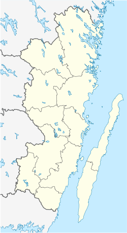
Löttorp (Swedish pronunciation: [ˈlœ̌tːɔrp])[2] is a locality situated in Borgholm Municipality, Kalmar County, Sweden with 438 inhabitants in 2010.[1] It is connected to the church village Högby on Route 136.
Löttorp provides a number of services for the northern part of the municipality, since the municipality's center, Borgholm, is 40 kilometres (25 mi) away. It has an elementary and middle school, and a library.[citation needed]
See also[edit]
References[edit]
- ^ a b c "Tätorternas landareal, folkmängd och invånare per km2 2005 och 2010" (in Swedish). Statistics Sweden. 14 December 2011. Archived from the original on 27 January 2012. Retrieved 10 January 2012.
- ^ Jöran Sahlgren; Gösta Bergman (1979). Svenska ortnamn med uttalsuppgifter (in Swedish). p. 16.
External links[edit]
![]() Media related to Löttorp at Wikimedia Commons
Media related to Löttorp at Wikimedia Commons


