
Camas, Washington: Difference between revisions
No edit summary |
m Reverted edits by 216.99.201.94 (talk) to last version by 209.242.148.130 |
||
| Line 78: | Line 78: | ||
*[[Greg Biffle]], NASCAR driver |
*[[Greg Biffle]], NASCAR driver |
||
*[[Tonya Harding]], figure ice skater |
*[[Tonya Harding]], figure ice skater |
||
*[[Kelly Wourms]], The coolest damn person this side of the Mississippi |
|||
==External links== |
==External links== |
||
{{Mapit-US-cityscale|45.591008|-122.412104}} |
{{Mapit-US-cityscale|45.591008|-122.412104}} |
||
Revision as of 04:52, 2 March 2007

Camas [ˈca mas] is a city in Clark County, Washington with a population of about 15,000. Officially incorporated on June 18, 1906, the city is named after the camas lily, a plant with an onion-like tuber prized by Native Americans. At the west end of downtown Camas is a large Georgia-Pacific paper-mill from which the high school teams get their name "the Papermakers". Historically, the commercial base of the city was based almost solely on the paper mill; however, the diversity of industries has been enhanced considerably in recent years by the influx of several white-collar, high-tech companies including Hewlett Packard, Sharp Microelectronics, Linear Technologies and Wafer Tech among others. Annual events include the summer "Camas Days," as well as other festivals and celebrations.
The east side of town borders the city of Washougal, Washington and the west side of town borders Vancouver, Washington. Camas lies along the Washington side of the Columbia River, across from Gresham, Oregon, and is part of the Portland, Oregon Metropolitan Statistical Area as defined by the United States Census Bureau. At this juncture the Columbia River is nearly a mile wide; vehicular traffic flows across the Columbia via Interstate bridges on both I-5 and I-205. The main road through town is the limited access SR-14 expressway.
One of the major geographical features of the city is Prune Hill, upon which a great portion of the residential area of the city is located. Prune hill is the remaining cinder cone of an extinct volcano.
Based on per capita income, Camas ranks 59th of 522 areas in the state of Washington.
Airports
Bodies of Water

Public Parks
- Crown Park
- Fallen Leaf Park
- Forest Home Park
- Goot Park
- Grass Valley Park
- Heritage Park
- Lacamas Park
- Lous Bloch Park
- Oak Park
- Prune Hill Sports Park
- Skate Park
Lacamas Park

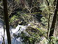
Lacamas Park encompasses Round Lake and runs against SR 500 on its west side. Across SR 500 is Lacamas Lake. The park is open year round from 7 am to dusk and includes barbecues, a play ground, trails around the park and lake, and access to the Camas Potholes.
The park features a network of trails which lead to the Camas Potholes and the camas lily fields. A 1.2 mile trail that loops around Round Lake starts and finishes near the parking lot. Young children may play in a small playground on the west side of the park. Tables are provided for picnicing as are waste receptacles designed to receive hot coals from grilling. Bathrooms are made available on a seasonal basis only.
Heritage Park

Heritage Park has facilities for launching boats into Lacamas Lake, a playground for young children, lots of open field, and small trails through the trees. The parking lot is very large and includes numerous long parking stalls to accommodate vehicles with trailers.
Gallery
-
 Competition is fierce at the Camas Days bathtub races
 -
 Downtown Camas, looking east
 -
 Downtown Camas, looking west
 -

-
-

-


Demographics
As of the censusTemplate:GR of 2000, there were 12,534 people, 4,480 households, and 3,422 families residing in the city. The population density was 443.6/km² (1,149.3/mi²). There were 4,736 housing units at an average density of 167.6/km² (434.3/mi²). The racial makeup of the city was 92.01% White, 0.69% African American, 0.69% Native American, 3.41% Asian, 0.14% Pacific Islander, 0.80% from other races, and 2.26% from two or more races. Hispanic or Latino of any race were 2.86% of the population.
There were 4,480 households out of which 42.6% had children under the age of 18 living with them, 63.9% were married couples living together, 8.5% had a female householder with no husband present, and 23.6% were non-families. 18.6% of all households were made up of individuals and 6.5% had someone living alone who was 65 years of age or older. The average household size was 2.78 and the average family size was 3.19.
In the city the population was spread out with 31.2% under the age of 18, 6.2% from 18 to 24, 32.5% from 25 to 44, 21.4% from 45 to 64, and 8.7% who were 65 years of age or older. The median age was 34 years. For every 100 females there were 96.2 males. For every 100 females age 18 and over, there were 94.6 males.
The median income for a household in the city was $60,187, and the median income for a family was $64,885. Males had a median income of $51,470 versus $31,985 for females. The per capita income for the city was $27,267. About 4.4% of families and 5.4% of the population were below the poverty line, including 6.4% of those under age 18 and 4.7% of those age 65 or over.
Sister Cities
Camas has the following sister cities, according to [1] and [2]:
Famous People
- Jimmie Rodgers, 1950s pop singer
- Greg Biffle, NASCAR driver
- Tonya Harding, figure ice skater