
Battle of Nivelle and Deccan Plateau: Difference between pages
Nivelle France |
Rajaramraok (talk | contribs) |
||
| Line 1: | Line 1: | ||
{{redirect|Deccan}} |
|||
{{Unreferenced|date=November 2007}} |
|||
{{main|Geography of India}} |
|||
{{Refimprove|date=December 2007}} |
|||
[[Image:Indiahills.png|thumb|right|250px|Deccan Plateau]] |
|||
The '''Deccan Plateau''', also known as the '''Peninsular Plateau''' or the '''Great Peninsular Plateau''',<ref name="militarygeogofSEasia">Page 46, {{cite book|last=Dr. Jadoan|first=Atar Singh|title=Military Geography of South-East Asia|publisher=Anmol Publications Pvt. Ltd.|location=India|date=Published September 2001|pages=270 pages|isbn=8126110082|url=http://books.google.co.uk/books?id=4M_bG9rpXRwC|accessdate=2008-06-08}}</ref> is a large [[plateau]] in [[India]], making up the majority of the southern part of the country. It is located between three mountain ranges and extends over eight Indian states. Its uplands make up a triangle nested within the familiar downward-pointing triangle of the Indian sub-continent's coastline.<ref name="sanctuary">{{cite web |
|||
|url=http://www.sanctuaryasia.com/resources/biogeozones/decpen.php |
|||
|title=The Deccan Peninsula |
|||
|publisher=sanctuaryasia |
|||
|accessdate=2007-01-05 |
|||
}}</ref> It is technically a vast [[plateau]] with a wide range of habitats, encompassing most of central and [[South India|southern India]].<ref name="rainwater">{{cite web |
|||
|url=http://www.rainwaterharvesting.org/eco/dp.htm |
|||
|title=The Deccan Plateau |
|||
|publisher=rainwaterharvesting.org |
|||
|accessdate=2007-01-05 |
|||
}}</ref> It is bounded in the west by the [[Western Ghats]] and in the east by the [[Eastern Ghats]] which each rise from their respective nearby coastal plains and nearly meet at the southern tip of India. These two formations form the southward-pointing [[vertex (geometry)|vertex]] of a triangle which encompasses the plateau with the roughly west-south-west to east-north-east running [[Satpura Range]] and [[Vindhya Range]] forming the third northern boundary of the region. The northern ranges separate the plateau from the heavily populated riverine plains of northern India. |
|||
It makes up large areas of the states of [[Maharashtra]] and [[Karnataka]] and parts of [[Andhra Pradesh]]. It has an elevation which ranges from 100 metres in the north to 1000 metres in the south. |
|||
{{Infobox Military Conflict |
|||
|conflict=Battle of Nivelle |
|||
This region is one of the most geologically stable land masses of the world.<ref name="rainwater"/> The Deccan forms the catchment areas of mighty rivers.<ref name="sanctuary"/> The name '''Deccan''' is an anglicised form of the [[Prakrit]] word ''{{IAST2|dakkhin}}'', itself derived from the [[Sanskrit]] word ''{{IAST2|dakṣiṇa-}}'' ({{lang-sa|दक्षिण}}), meaning 'South'.<ref>{{cite web |
|||
|partof=the [[Peninsular War]] |
|||
|url=http://india.punjabilit.com/land/deccan_plateau.htm |
|||
|image= |
|||
|title=Deccan Plateau |
|||
|caption= |
|||
|publisher=punjabilit.com |
|||
|date=[[November 10]], [[1813]] |
|||
|accessdate=2007-01-05 |
|||
|place=[[Nivelle river|River Nivelle]], [[France]] |
|||
}}</ref> |
|||
|result=Allied victory |
|||
|combatant1={{flagicon|France}} [[First French Empire|French Empire]] |
|||
|combatant2={{flagicon|United Kingdom}} [[United Kingdom of Great Britain and Ireland|United Kingdom]],<br>{{flag|Spain|1785}},<br>{{flagicon|Portugal|1707}} [[Kingdom of Portugal|Portugal]] |
|||
|commander1=[[Nicolas Jean de Dieu Soult]] |
|||
|commander2=[[Arthur Wellesley, 1st Duke of Wellington|Arthur Wellesley, 1st Marquess of Wellington]] |
|||
|strength1=60,000 |
|||
|strength2=80,000 |
|||
|casualties1=4,351 dead or wounded |
|||
|casualties2=2,450 dead or wounded |
|||
}} |
|||
{{Campaignbox Peninsular War (1813-1814)}} |
|||
The '''Battle of Nivelle''' ([[November 10]], [[1813]]) took place in front of the [[Nivelle river|River Nivelle]] near the end of the [[Peninsular War]] (1808-1814). After the Allied siege of [[San Sebastián]], [[Arthur Wellesley, 1st Duke of Wellington|Wellington]]'s 80,000 British, Portuguese and Spanish troops (20,000 of the Spaniards were untried in battle) were in hot pursuit of [[Nicolas Jean de Dieu Soult|Marshal Soult]] who only had 60,000 men to place in a 20-mile perimeter. After the [[Light Division]], the main British army was ordered to attack and the 3rd [[Division (military)|Division]] split Soult's army into two. By 2 o'clock, Soult was in retreat and the British in a strong offensive position. Soult had lost 4,351 men to Wellington's 2,450. |
|||
<!-- As suggested by some linguists it is because, as Aryans came to India, they, while looking towards the east, called it 'Daksina'. As phonologically it resembles "Dakha Sadjna", meaning right side or front as Aryans came from the north and moved forward up to Deccan.{{fact}} |
|||
==Background == |
|||
In the [[Siege of San Sebastian]], the Anglo-Portuguese stormed and captured the port at the beginning of September 1813. In the [[Battle of San Marcial]] on [[August 31]], Soult failed to break through the Spanish defences in his final attempt to relieve the siege. The French army then fell back to defend the Bidassoa River, which forms the French-Spanish frontier near the coast. |
|||
Ancient [[Dakshinapatha]] gave its name to modern '''[[Deccan]]''' or '''Dekkan'''. |
|||
At dawn on [[October 7]], the Anglo-Allied army overran the French river defences in the [[Battle of the Bidassoa (1813)|Battle of the Bidassoa]] in a surprise crossing. During this action, the allies also captured several fortified positions in the area of La Rhune mountain. Both sides lost about 1,600 men in these actions. |
|||
In the [[Mahabharata]], Dakshinapatha is placed beyond Avanti and [[Vindhya]]s and to south of the kingdom of [[Vidarbha]]s and southern [[Kosala]]s, the latter being located on the banks of the rivers [[Wardha River|Wardha]] and [[Mahanadi]]. --> |
|||
==Disposition== |
|||
Arrayed in front of the course of the '''[[Nivelle river|River Nivelle]]''', whose route was marked by a series of hills on which the French had built strong defensive positions or redoubts, was the French army under [[Marshal Soult]]. Soult's lines stretched from the shores of the Atlantic on the French right flank to the snow-covered pass of Roncesvalles on the left, a parameter of about 20 miles. With only 60,000 men, Soult was stretched to an almost impossible point. This also means that he could not hold troops back as [[reserves]], something which may have turned the tide of the battle. As Soult moved back to his base at [[Bayonne]], his position strengthened but he was not quick enough and Wellington caught him up. |
|||
==Geography== |
|||
'''The French position''' was dominated by the [[La Rhune|Greater Rhune]], a gorse-covered, craggy mountain nearly 3,000 feet high. Separated from the Greater Rhune by a ravine, roughly 700 yards below it, is the Lesser Rhune along the precipitous crest of which the French had constructed three defensive positions. If the French defences on [[La Rhune]] could be taken [[Soult]]'s position would become very dangerous as it would open him to attack from all elements of the British three point pincer plan. |
|||
[[Image:Hogenakkal falls.jpg|thumb|right|250px|[[Hogenakal Falls]]]] |
|||
[[Image:Hampi Fluss Haupttempel.jpg|thumb|right|250px|Near [[Hampi]]]] |
|||
<!-- [[Image:Deccan.jpg|right|thumb|175px|The Deccan Plateau comprises most of central and southern India.]] --> |
|||
The Deccan Plateau lies south of the [[Indo-Gangetic plain]]. The Western Ghats Mountain Range is tall and blocks the moisture from the southwest [[monsoon]] from reaching the Deccan Plateau, so the region receives very little rainfall.<ref>{{cite web |
|||
|url=http://www.nationalgeographic.com/wildworld/profiles/terrestrial/im/im0209.html |
|||
|title=South Deccan Plateau dry deciduous forests d(IM0209) |
|||
|publisher=nationalgeographic.com atul atul atul |
|||
|accessdate=2007-01-05 |
|||
}}</ref><ref>{{cite web |
|||
|url=http://www.worldwildlife.org/wildworld/profiles/terrestrial/im/im0209_full.html |
|||
|title=South Deccan Plateau dry deciduous forests (IM0209) |
|||
|publisher=worldwildlife.org |
|||
|accessdate=2007-01-05 |
|||
}}</ref> The eastern Deccan Plateau is at a lower elevation spanning the southeastern coast of India. Its forests are also relatively dry but serve to retain the rain to form streams that feed into rivers that flow into basins and then into the [[Bay of Bengal]].<ref name="sanctuary"/><ref>{{cite web |
|||
|url=http://www.panda.org/about_wwf/where_we_work/ecoregions/edeccan_plateau_moist_forests.cfm |
|||
|title=Eastern Deccan Plateau Moist Forests |
|||
|publisher=World Wildlife Fund |
|||
|accessdate=2007-01-05 |
|||
}}</ref> |
|||
The [[Godavari River]] and its tributaries, including the [[Indravati River]], drain most of the northern portion of the plateau, rising in the Western Ghats and flowing east towards the [[Bay of Bengal]]. The [[Tungabhadra River]], [[Krishna River]] and its tributaries, including the [[Bhima River]], which also run from west to east, drain the central portion of the plateau. The southernmost portion of the plateau is drained by the [[Kaveri River]], which rises in the Western Ghats of Karnataka and bends south to break through the [[Nilgiri]] hills at [[Hogenakal Falls]] into Tamil Nadu, then forming the [[Sivasamudram Falls]] at the island town of [[Shivanasamudra]], the second-biggest waterfall in [[India]] and the sixteenth-largest in the world,<ref>{{cite web |
|||
'''Wellington's plan''' was to distribute troops along the whole of Soult's line but make his main attack in the centre. Any breakthrough in the centre or the French left [[flank]] would enable the British to cut off the French right Flank. So, Wellington ordered that the British left (attacking the French right) would be led by Sir [[John Hope]] and would involve the [[1st Infantry Division (United Kingdom)|1st]] and [[5th Infantry Division (United Kingdom)|5th Divisions]] as well as Freire's Spaniards. [[Beresford]] would lead the main Allied attack against the French centre with the [[3rd Infantry Division (United Kingdom)|3rd]], [[4th Infantry Division (United Kingdom)|4th]], [[7th Infantry Division (United Kingdom)|7th]] and [[Light Division]]s, while on the British right (attacking the French left ) [[Hill]] would attack with the [[2nd Infantry Division (United Kingdom)|2nd]] and [[6th Infantry Division (United Kingdom)|6th Divisions]], supported by [[Morillo]]'s Spaniards and [[Hamilton]]'s Portuguese. Wellington decided to attack on the 10th of November. |
|||
|url=http://www.cauvery.com/ |
|||
|title=Shivasamudram Falls |
|||
|publisher= |
|||
|accessdate=2006-11-11 |
|||
}}</ref> before flowing into the [[Stanley Reservoir]] and the [[Mettur Dam]] that created the reservoir and finally emptying into the [[Bay of Bengal]]. The two rivers that do not flow into the Bay Of Bengal are Narmada and Tapi. They start in the Eastern Ghats and flow into the Arabian sea. |
|||
The rivers of the [[Himalayas]] are snow-fed and so perennial throughout the year. But the rivers of the Deccan Plateau depend on the rains and so they dry up in the summers.{{Left66|end=1}} |
|||
==Battle== |
|||
The [[Climate]] of the region varies from [[Sub Tropical]] in the extreme north to [[Tropical]] in most of the region with distinct wet and dry seasons. Rains falls during the wet or [[monsoon]] season from about June to October. March to June can be very dry and hot with temperatures exceeding 40°C regularly. |
|||
The '''battle started''' just before dawn as the [[Light Division]] headed towards the [[plateau]] on the summit of the Greater Rhune (the summit had been garrisoned by French troops but they had fled after the [[skirmish]] on the River Bidassoa, fearing to be cut off from their own army). The objective of the [[military division|division]] was to sweep the three defensive forts the French had constructed out of the battle. They moved down into the ravine in front of the Lesser Rhune and were ordered to lie down and await the order to attack. After the signal from a [[artillery battery|battery]] of [[cannon]], the offensive began. It started with the men of the [[43rd Regiment of Foot|43rd]], [[52nd (Oxfordshire) Regiment of Foot|52nd]] and [[95th Rifles|95th]] - with the 17th Portuguese Caçadores in support - storming the - redoubts on the crest of the Rhune. Despite this being a risky move and the men being almost exhausted, the surprise and boldness of the British sent the French fleeing towards other forts on other hills. |
|||
==Geology== |
|||
While the 43rd and 95th were dealing with the French on the Rhune, there still remained one very strong star-shaped fort below on the Mouiz [[plateau]] which reached out towards the coast. This was attacked by [[Colborne]]'s 52nd Light Infantry, supported by [[riflemen]] from the 95th. Once again, the French were surprised and the British succeeded. They had, in the French eyes, appeared from the ground at which point, in danger of being cut off, the French [[soldiers]] quickly fled leaving [[Colborne]] in possession of the fort and other trenches without loss of a single fatal casualty. |
|||
[[Image:Deccanplateauscene.jpg]] |
|||
The vast [[volcanic]] basalt beds of the Deccan were laid down in the massive [[Deccan Traps]] eruption, which occurred towards the end of the [[Cretaceous]] period, between 67 and 65 million years ago. Some [[paleontologist]]s speculate that this eruption may have accelerated the extinction of the [[dinosaur]]s. Layer after layer was formed by the volcanic activity that lasted many thousands of years, and when the volcanoes became extinct, they left a region of highlands with typically vast stretches of flat areas on top like a table. Hence it is also known as '''Table Top'''. The volcanic hotspot that produced the Deccan traps is hypothesized to lie under the present day island of [[Réunion]] in the Indian Ocean. |
|||
Typically the Deccan Plateau is made up of [[basalt]] extending up to [[Bor Ghat]] near [[Karjat]]. This is an [[extrusive]] [[igneous rock]]. Also in certain sections of the region, we can find [[granite]], which is an [[intrusive]] [[igneous rock]]. The difference between these two rock types is: basalt rock forms on eruption of lava, that is, on the surface (either out of a volcano, or through massive fissures -- as in the Deccan basalts -- in the ground), while granite forms deep within the Earth. Granite is a [[felsic]] rock, meaning it is rich in [[potassium feldspar]] and [[quartz]]. This composition is continental in origin (meaning it is the primary composition of the [[continental crust]]). Since it cooled underground, it has large invisible crystals. Basalt, on the other hand, is [[mafic]] in composition -- meaning it is rich in [[pyroxene]] and, in some cases, [[olivine]], both of which are Mg-Fe rich minerals. Basalt is similar in composition to [[Mantle (geology)|mantle]] rocks, indicating that it came from the mantle and did not mix with continental rocks. Basalt forms in areas that are spreading, whereas granite forms in areas that are colliding. Since both rocks are found in the Deccan Plateau, it indicates two different environments of formation. |
|||
Shortly, the '''main British assault''' began with the nine divisions fanning out over a five mile front. When the 3rd division took the bridge at Amotz, all French resistance broke as any communication between the two halves of [[Soult]]'s army was now impossible. The French resistance melted away and soon they were in full retreat (by 2 o'clock they were streaming across the Nivelle) having lost 4351 men to Wellington's 2450. |
|||
The Deccan is rich in minerals. Primary mineral ores found in this region are [[mica]] and [[iron]] ore in the [[Chota Nagpur Plateau|Chhota Nagpur]] region, and [[diamond]]s, [[gold]] and other [[metal]]s in the [[Golconda]] region. |
|||
==Aftermath== |
|||
Had Wellington pursued the French he might have completely cut off the right wing and force it to surrender. As it was, Wellington, a keen despiser of any night attack, called off the pursuit and his troops camped on the battlefield. |
|||
==People== |
|||
The British success against [[Soult]] allowed them to march deep inside France before they met any serious resistance. The French peasants acted kindly towards the British because they paid them for their food whereas the French raided their own towns and villages.{{Fact|date=March 2007}} |
|||
The Deccan is home to many [[language]]s and people. [[Bhil]] and [[Gond]] people live in the hills along the northern and northeastern edges of the plateau, and speak various languages that belong to both the [[Indo-European languages|Indo-European]] and [[Dravidian languages|Dravidian]] families of languages. [[Marathi language|Marathi]], an [[Indo-Aryan languages|Indo-Aryan language]], is the main language of the north-western portion of the Deccan plateau. Speakers of [[Telugu language|Telugu]] and [[Kannada language|Kannada]], the predominant languages of [[Andhra Pradesh]] and [[Karnataka]] respectively, occupy those states' portions of the plateau. [[Tamil language|Tamil]] is the main language of the country to the south of the plateau, and [[Malayalam]] that of the hills and coast to the south-west. The city of [[Hyderabad, India|Hyderabad]] is an important centre of [[Urdu]] language in the Deccan; its surrounding areas also host a notable population of Urdu speakers. |
|||
The chief crop is [[cotton]], however, [[sugarcane]], [[rice]], and other crops are also common. Several Indian states cover parts of the Deccan: [[Maharashtra]] covers most of the northern plateau, and [[Chhattisgarh]] the northeast corner. [[Andhra Pradesh]] covers the east-central portion of the Deccan, and [[Karnataka]] the west-central and most of the southern portion of the plateau, with the southernmost portion in [[Tamil Nadu]]. The largest city in the Deccan is [[Bangalore, India|Bangalore]], southern India. Other major cities include [[Hyderabad, India|Hyderabad]], the capital of Andhra Pradesh, [[Pune]], [[Nagpur]], [[Aurangabad]], in Maharashtra. |
|||
[[Category:Battles of the Peninsular War]] |
|||
[[Category:1813 in France]] |
|||
==History== |
|||
[[fr:Bataille de la Nivelle]] |
|||
{{See also|History of India|Mughal Empire|Deccan sultanates|Chalukya dynasty|Chola dynasty|Hoysala Empire|Kakatiya dynasty|Rashtrakuta|Yadava Dynasty|Vijayanagara Empire|Maratha Empire|l11='''Maratha Empire'''}} |
|||
[[Image:Deccan Horse, Bazentin Ridge 1916.jpg|thumb|right|200px|Battle of Bazentin Ridge 14 -17 July: The Deccan horse drawn up in ranks in the Carnoy Valley waiting for the opportunity to attack]] |
|||
The detailed and authentic history of the Deccan only begins with the 13th century A.D. Of the early history the main facts established are the growth of the [[Maurya]] empire (250 B.C.) and the invasion (A.D. 100) of the Scythic tribes known as the Sakas, Pahlavas and Yavanas, which led to the establishment of the power of the Kshaharata satraps in western India. |
|||
In 1294 Ala-ud-Din Khilji, emperor of Delhi, invaded the Deccan, stormed [[Devagiri]], and reduced the Yadava rajas of Maharashtra to the position of tributary princes (see [[Daulatabad]]), then proceeding southward overran [[Telingana]] and [[Carnatic]]. With this event the continuous history of the Deccan begins. In 1307, owing to non-payment of tribute, a fresh series of Mussulman incursions began, under Malik Kafur, issuing in the final ruin of the Yadava power; and in 1338 the reduction of the Deccan was completed by Mohommad bin Tughlak. The imperial hegemony was of brief duration as soon Telingana and Karnataka speedily reverted to their former masters and these defections by the Hindu states was soon followed by a general revolt of the [[Mussulman]] governors, resulting in the establishment in 1347 of the independent Muslim dynasty of [[Bahmani]], and the consequent withdrawal of the power of Delhi from the territory south of the [[Narmada|Narmada River]]. |
|||
In the power struggles which ensued, the Hindu kingdom of Telingana fell bit by bit to the Bahamani dynasty, who advanced their frontier to [[Golkonda]] in 1373, to [[Warangal]] in 1421, and to the [[Bay of Bengal]] in 1472. On the dissolution of the Bahmani empire (1482), its dominions were distributed into the five Muslim states of Golkonda, Bijapur, Ahmednagar, Bidar and Berar. To the south of these the great Hindu state of Carnatic or [[Vijayanagar]] still survived; but this, too, was destroyed, at the battle of Talikota (1565) by a league of the Muslim powers. These latter in their turn soon disappeared. Berar had already been annexed by [[Ahmednagar]] in 1572, and Bidar was absorbed by Bijapur in 1609. Ahmednagar was incorporated in the [[Mughal Empire]] in 1598, Bijapur in 1686, and Golkonda in 1688. In 1674, [[Shivaji]] laid the foundation of the [[Maratha Empire]]. The rule of the Delhi emperors in the Deccan did not, however, long survive. After 1707, the [[Maratha]]s acquired the right of levying tribute in southern India. A few years later the Aurangzeb's viceroy in Ahmednagar, [[Nizam-ul-Mulk]], established the seat of an independent government at Hyderabad (1724). The remainder of the imperial possessions in the peninsula were held by chieftains acknowledging the supremacy of one or other of these two potentates. In the sequel, Mysore became the prize of the Muslim usurper Hyder Ali. During the contests for power which ensued about the middle of the 18th century between the native chiefs, the French and the English took opposite sides. After a brief course of triumph, the interests of France declined, and a new empire in India was established by the British. Mysore formed one of their earliest conquests in the Deccan. Tanjore and the Carnatic were shortly after annexed to their dominions. In 1818 the forfeited possessions of the Peshwa added to their extent; and these acquisitions, with others which have more recently fallen to the paramount power by cession, conquest, or failure of heirs, form a continuous territory stretching from the Narmada to Cape Comorin(Kanyakumari). This vast tract was divided by the British between the presidencies of Madras and Bombay, together with the native states of Hyderabad and Mysore, and those of Kolhapur, Sawantwari, Travancore, Cochin, and the petty possessions of France and Portugal. (EB 1911) |
|||
<gallery> |
|||
Image:Indischer Maler um 1660 002.jpg|Deccan style |
|||
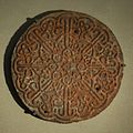
Image:Calligraphic emblem MET 24-01.jpg|Calligraphic emblem of sculpted sandstone - 16th century |
|||
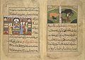
Image:Nimmatnama-i Nasiruddin-Shahi 283.jpg|''Nimmatnama-i Nasiruddin-Shahi'' (the Book of Recipes) |
|||
</gallery> |
|||
== See also == |
|||
* [[South India]], which includes '''Deccan'''. |
|||
* [[Mysore Plateau]] |
|||
* [[Vijayanagara Empire]] |
|||
* [[Kakatiya]] empire |
|||
* [[Bayaluseemae]] |
|||
==Notes== |
|||
<references/> |
|||
== References == |
|||
* [http://www.ibiblio.org/sripedia/ebooks/mw/0400/mw__0498.html Monier-Williams Sanskrit-English Dictionary, p. 498] (scanned image at ''SriPedia Initiative''): Sanskrit ''dakṣiṇa'' meaning 'right', 'southern'. |
|||
* {{1911}} |
|||
==External links== |
|||
*[http://www.cyclingscholar.com/decca.html Photos of Deccan Plateau] |
|||
*[http://www.kamat.com/kalranga/deccan/deckings.htm Dynasties of Deccan] |
|||
*[http://www.sanctuaryasia.com/resources/biogeozones/decpen.php The Deccan Peninsula] |
|||
*[http://www.worldwildlife.org/wildworld/profiles/terrestrial/im/im0201_full.html Central Deccan Plateau dry deciduous forests] |
|||
*[http://web.mit.edu/nchat/www/research2a.html Geology of Deccan Plateau] |
|||
*[http://www.deccan.net/ Deccan South Indian Online] |
|||
{{Geography topics}} |
|||
{{Physical geography topics}} |
|||
{{GeoSouthAsia}} |
|||
[[Category:Plateaus]] |
|||
[[Category:Landforms of India]] |
|||
[[Category:Physiographic divisions]] |
|||
[[cs:Dekánská plošina]] |
|||
[[da:Deccanplateauet]] |
|||
[[de:Dekkan]] |
|||
[[es:Decán]] |
|||
[[eu:Dekan goi-ordokia]] |
|||
[[fa:دکن]] |
|||
[[fr:Deccan]] |
|||
[[hr:Dekan (visoravan)]] |
|||
[[it:Altopiano del Deccan]] |
|||
[[he:רמת דקאן]] |
|||
[[lt:Dekano plokščiakalnis]] |
|||
[[hu:Dekkán-fennsík]] |
|||
[[mr:दख्खनचे पठार]] |
|||
[[nl:Hoogland van Dekan]] |
|||
[[ja:デカン高原]] |
|||
[[no:Deccan]] |
|||
[[nn:Deccan]] |
|||
[[pl:Dekan (płaskowyż)]] |
|||
[[pt:Decão]] |
|||
[[ru:Декан (плоскогорье)]] |
|||
[[sk:Dekanská plošina]] |
|||
[[sr:Висораван Декан]] |
|||
[[sv:Deccan]] |
|||
[[ta:தக்காணப் பீடபூமி]] |
|||
[[tr:Deccan yaylası]] |
|||
[[zh:德干高原]] |
|||
Revision as of 14:18, 11 October 2008
This article needs additional citations for verification. (December 2007) |

The Deccan Plateau, also known as the Peninsular Plateau or the Great Peninsular Plateau,[1] is a large plateau in India, making up the majority of the southern part of the country. It is located between three mountain ranges and extends over eight Indian states. Its uplands make up a triangle nested within the familiar downward-pointing triangle of the Indian sub-continent's coastline.[2] It is technically a vast plateau with a wide range of habitats, encompassing most of central and southern India.[3] It is bounded in the west by the Western Ghats and in the east by the Eastern Ghats which each rise from their respective nearby coastal plains and nearly meet at the southern tip of India. These two formations form the southward-pointing vertex of a triangle which encompasses the plateau with the roughly west-south-west to east-north-east running Satpura Range and Vindhya Range forming the third northern boundary of the region. The northern ranges separate the plateau from the heavily populated riverine plains of northern India.
It makes up large areas of the states of Maharashtra and Karnataka and parts of Andhra Pradesh. It has an elevation which ranges from 100 metres in the north to 1000 metres in the south.
This region is one of the most geologically stable land masses of the world.[3] The Deccan forms the catchment areas of mighty rivers.[2] The name Deccan is an anglicised form of the Prakrit word dakkhin, itself derived from the Sanskrit word dakṣiṇa- (Sanskrit: दक्षिण), meaning 'South'.[4]
Geography


The Deccan Plateau lies south of the Indo-Gangetic plain. The Western Ghats Mountain Range is tall and blocks the moisture from the southwest monsoon from reaching the Deccan Plateau, so the region receives very little rainfall.[5][6] The eastern Deccan Plateau is at a lower elevation spanning the southeastern coast of India. Its forests are also relatively dry but serve to retain the rain to form streams that feed into rivers that flow into basins and then into the Bay of Bengal.[2][7]
The Godavari River and its tributaries, including the Indravati River, drain most of the northern portion of the plateau, rising in the Western Ghats and flowing east towards the Bay of Bengal. The Tungabhadra River, Krishna River and its tributaries, including the Bhima River, which also run from west to east, drain the central portion of the plateau. The southernmost portion of the plateau is drained by the Kaveri River, which rises in the Western Ghats of Karnataka and bends south to break through the Nilgiri hills at Hogenakal Falls into Tamil Nadu, then forming the Sivasamudram Falls at the island town of Shivanasamudra, the second-biggest waterfall in India and the sixteenth-largest in the world,[8] before flowing into the Stanley Reservoir and the Mettur Dam that created the reservoir and finally emptying into the Bay of Bengal. The two rivers that do not flow into the Bay Of Bengal are Narmada and Tapi. They start in the Eastern Ghats and flow into the Arabian sea.
The rivers of the Himalayas are snow-fed and so perennial throughout the year. But the rivers of the Deccan Plateau depend on the rains and so they dry up in the summers.Template:Left66 The Climate of the region varies from Sub Tropical in the extreme north to Tropical in most of the region with distinct wet and dry seasons. Rains falls during the wet or monsoon season from about June to October. March to June can be very dry and hot with temperatures exceeding 40°C regularly.
Geology
File:Deccanplateauscene.jpg The vast volcanic basalt beds of the Deccan were laid down in the massive Deccan Traps eruption, which occurred towards the end of the Cretaceous period, between 67 and 65 million years ago. Some paleontologists speculate that this eruption may have accelerated the extinction of the dinosaurs. Layer after layer was formed by the volcanic activity that lasted many thousands of years, and when the volcanoes became extinct, they left a region of highlands with typically vast stretches of flat areas on top like a table. Hence it is also known as Table Top. The volcanic hotspot that produced the Deccan traps is hypothesized to lie under the present day island of Réunion in the Indian Ocean.
Typically the Deccan Plateau is made up of basalt extending up to Bor Ghat near Karjat. This is an extrusive igneous rock. Also in certain sections of the region, we can find granite, which is an intrusive igneous rock. The difference between these two rock types is: basalt rock forms on eruption of lava, that is, on the surface (either out of a volcano, or through massive fissures -- as in the Deccan basalts -- in the ground), while granite forms deep within the Earth. Granite is a felsic rock, meaning it is rich in potassium feldspar and quartz. This composition is continental in origin (meaning it is the primary composition of the continental crust). Since it cooled underground, it has large invisible crystals. Basalt, on the other hand, is mafic in composition -- meaning it is rich in pyroxene and, in some cases, olivine, both of which are Mg-Fe rich minerals. Basalt is similar in composition to mantle rocks, indicating that it came from the mantle and did not mix with continental rocks. Basalt forms in areas that are spreading, whereas granite forms in areas that are colliding. Since both rocks are found in the Deccan Plateau, it indicates two different environments of formation.
The Deccan is rich in minerals. Primary mineral ores found in this region are mica and iron ore in the Chhota Nagpur region, and diamonds, gold and other metals in the Golconda region.
People
The Deccan is home to many languages and people. Bhil and Gond people live in the hills along the northern and northeastern edges of the plateau, and speak various languages that belong to both the Indo-European and Dravidian families of languages. Marathi, an Indo-Aryan language, is the main language of the north-western portion of the Deccan plateau. Speakers of Telugu and Kannada, the predominant languages of Andhra Pradesh and Karnataka respectively, occupy those states' portions of the plateau. Tamil is the main language of the country to the south of the plateau, and Malayalam that of the hills and coast to the south-west. The city of Hyderabad is an important centre of Urdu language in the Deccan; its surrounding areas also host a notable population of Urdu speakers.
The chief crop is cotton, however, sugarcane, rice, and other crops are also common. Several Indian states cover parts of the Deccan: Maharashtra covers most of the northern plateau, and Chhattisgarh the northeast corner. Andhra Pradesh covers the east-central portion of the Deccan, and Karnataka the west-central and most of the southern portion of the plateau, with the southernmost portion in Tamil Nadu. The largest city in the Deccan is Bangalore, southern India. Other major cities include Hyderabad, the capital of Andhra Pradesh, Pune, Nagpur, Aurangabad, in Maharashtra.
History

The detailed and authentic history of the Deccan only begins with the 13th century A.D. Of the early history the main facts established are the growth of the Maurya empire (250 B.C.) and the invasion (A.D. 100) of the Scythic tribes known as the Sakas, Pahlavas and Yavanas, which led to the establishment of the power of the Kshaharata satraps in western India.
In 1294 Ala-ud-Din Khilji, emperor of Delhi, invaded the Deccan, stormed Devagiri, and reduced the Yadava rajas of Maharashtra to the position of tributary princes (see Daulatabad), then proceeding southward overran Telingana and Carnatic. With this event the continuous history of the Deccan begins. In 1307, owing to non-payment of tribute, a fresh series of Mussulman incursions began, under Malik Kafur, issuing in the final ruin of the Yadava power; and in 1338 the reduction of the Deccan was completed by Mohommad bin Tughlak. The imperial hegemony was of brief duration as soon Telingana and Karnataka speedily reverted to their former masters and these defections by the Hindu states was soon followed by a general revolt of the Mussulman governors, resulting in the establishment in 1347 of the independent Muslim dynasty of Bahmani, and the consequent withdrawal of the power of Delhi from the territory south of the Narmada River.
In the power struggles which ensued, the Hindu kingdom of Telingana fell bit by bit to the Bahamani dynasty, who advanced their frontier to Golkonda in 1373, to Warangal in 1421, and to the Bay of Bengal in 1472. On the dissolution of the Bahmani empire (1482), its dominions were distributed into the five Muslim states of Golkonda, Bijapur, Ahmednagar, Bidar and Berar. To the south of these the great Hindu state of Carnatic or Vijayanagar still survived; but this, too, was destroyed, at the battle of Talikota (1565) by a league of the Muslim powers. These latter in their turn soon disappeared. Berar had already been annexed by Ahmednagar in 1572, and Bidar was absorbed by Bijapur in 1609. Ahmednagar was incorporated in the Mughal Empire in 1598, Bijapur in 1686, and Golkonda in 1688. In 1674, Shivaji laid the foundation of the Maratha Empire. The rule of the Delhi emperors in the Deccan did not, however, long survive. After 1707, the Marathas acquired the right of levying tribute in southern India. A few years later the Aurangzeb's viceroy in Ahmednagar, Nizam-ul-Mulk, established the seat of an independent government at Hyderabad (1724). The remainder of the imperial possessions in the peninsula were held by chieftains acknowledging the supremacy of one or other of these two potentates. In the sequel, Mysore became the prize of the Muslim usurper Hyder Ali. During the contests for power which ensued about the middle of the 18th century between the native chiefs, the French and the English took opposite sides. After a brief course of triumph, the interests of France declined, and a new empire in India was established by the British. Mysore formed one of their earliest conquests in the Deccan. Tanjore and the Carnatic were shortly after annexed to their dominions. In 1818 the forfeited possessions of the Peshwa added to their extent; and these acquisitions, with others which have more recently fallen to the paramount power by cession, conquest, or failure of heirs, form a continuous territory stretching from the Narmada to Cape Comorin(Kanyakumari). This vast tract was divided by the British between the presidencies of Madras and Bombay, together with the native states of Hyderabad and Mysore, and those of Kolhapur, Sawantwari, Travancore, Cochin, and the petty possessions of France and Portugal. (EB 1911)
-
 Deccan style
 -
 Calligraphic emblem of sculpted sandstone - 16th century
 -
 Nimmatnama-i Nasiruddin-Shahi (the Book of Recipes)


See also
- South India, which includes Deccan.
- Mysore Plateau
- Vijayanagara Empire
- Kakatiya empire
- Bayaluseemae
Notes
- ^ Page 46, Dr. Jadoan, Atar Singh (Published September 2001). Military Geography of South-East Asia. India: Anmol Publications Pvt. Ltd. pp. 270 pages. ISBN 8126110082. Retrieved 2008-06-08.
{{cite book}}: Check date values in:|date=(help) - ^ a b c "The Deccan Peninsula". sanctuaryasia. Retrieved 2007-01-05.
- ^ a b "The Deccan Plateau". rainwaterharvesting.org. Retrieved 2007-01-05.
- ^ "Deccan Plateau". punjabilit.com. Retrieved 2007-01-05.
- ^ "South Deccan Plateau dry deciduous forests d(IM0209)". nationalgeographic.com atul atul atul. Retrieved 2007-01-05.
- ^ "South Deccan Plateau dry deciduous forests (IM0209)". worldwildlife.org. Retrieved 2007-01-05.
- ^ "Eastern Deccan Plateau Moist Forests". World Wildlife Fund. Retrieved 2007-01-05.
- ^ "Shivasamudram Falls". Retrieved 2006-11-11.
References
- Monier-Williams Sanskrit-English Dictionary, p. 498 (scanned image at SriPedia Initiative): Sanskrit dakṣiṇa meaning 'right', 'southern'.
- This article incorporates text from a publication now in the public domain: Chisholm, Hugh, ed. (1911). Encyclopædia Britannica (11th ed.). Cambridge University Press.
{{cite encyclopedia}}: Missing or empty|title=(help)
External links
- Photos of Deccan Plateau
- Dynasties of Deccan
- The Deccan Peninsula
- Central Deccan Plateau dry deciduous forests
- Geology of Deccan Plateau
- Deccan South Indian Online
| Branches |
| ||||||||
|---|---|---|---|---|---|---|---|---|---|
| Techniques and tools |
| ||||||||
| Institutions | |||||||||
| Education | |||||||||
 | ||