Água de Pena
| Água de Pena | ||||||
|---|---|---|---|---|---|---|
|
||||||
| Basic data | ||||||
| Autonomous Region : | Madeira | |||||
| Concelho : | Machico | |||||
| Coordinates : | 32 ° 42 ′ N , 16 ° 47 ′ W | |||||
| Residents: | 2434 (as of June 30, 2011) | |||||
| Surface: | 5.15 km² (as of January 1, 2010) | |||||
| Population density : | 473 inhabitants per km² | |||||
| Height: | 0 m | |||||
| Postal code : | 9200-224 | |||||
| politics | ||||||
| Mayor : | Avelino Perestrelo da Conceição ( PS ) | |||||
| Address of the municipal administration: | Junta de Freguesia de Água de Pena Estrada Regional 237 nº 5, Igreja 9200-224 Água de Pena |
|||||
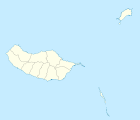
Água de Pena is a municipality ( freguesia ) in the district ( concelho ) of Machico , in the northeast of the Portuguese island of Madeira . On June 30, 2011, Água de Pena had 2434 inhabitants in an area of 5.1 km².
history
Zarco , the newcomers to the island of Madeira, landed in 1419 in Machico. The settlement of the area followed. In 1560 Água de Pena became its own municipality.
In connection with the expansion of Madeira Airport , which opened in 2000 , its runway was extended into the municipality.
administration
The municipality ( Freguesia ) Água de Pena consists of the following localities ( Sítios ) and new housing developments ( Bairros ):
- Bemposta
- Igreja (town hall)
- Lombo
- Queimada
- Bairro da Bemposta
- Bairro dos Pescadores
Web links
Commons : Água de Pena - collection of images, videos and audio files
Individual evidence
- ↑ www.ine.pt - indicator resident population by place of residence and sex; Decennial in the database of the Instituto Nacional de Estatística
- ↑ Overview of code assignments from Freguesias on epp.eurostat.ec.europa.eu
- ↑ History page on the website of the community ( Memento from January 22, 2011 in the Internet Archive ), accessed on August 29, 2013


