Eastern horseshoe
| Eastern horseshoe | ||
|---|---|---|
|
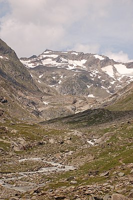
High Horseshoe (left) and Eastern Horseshoe (right) from the southeast. Including the Schlaitner Keesflecken and the Umbaltal. |
||
| height | 3171 m above sea level A. | |
| location | Tyrol , Austria and South Tyrol , Italy | |
| Mountains | Horseshoe Ridge , Venediger Group | |
| Coordinates | 47 ° 3 '37 " N , 12 ° 13' 21" E | |
|
|
||
| First ascent | F. Boffa with Führer Voppichler and Surveyor (1921) | |
| Normal way | From the Kleine-Philipp-Reuter-Hütte over the Althauskees and the Leipziger Schartl over the northeast ridge ( II ) | |
The Eastern Horseshoe is 3171 m above sea level. A. high mountain peaks of the Rosshufkamm in the Venediger group . It lies on the border between Austria and Italy or East and South Tyrol . The first ascent took place in 1921 by F. Boffa with guide Voppichler and an Austrian surveyor.
location
The horseshoe, which gives the ridge its name, consists of four summit points. From west to east these are the western horseshoe ( 3144 m slm ), the middle horseshoe ( 3180 m slm ), the high horseshoe 3199 m above sea level. A. and the Eastern Horseshoe, whereby the Eastern Horseshoe is merely a secondary peak of the High Horseshoe. East of the Eastern Horseshoe is the Leipziger Schartl, which separates the Rosshuf from the Althausschneide with the Althausschneidespitze and the Althausschneideturm . The course of the ridge also marks the border between the East Tyrolean community of Prägraten am Großvenediger and the South Tyrolean community of Prettau . The Schlaitner Keesflecken stretch south-east of the Eastern Rosshufs and the Lahnerkees to the north. The closest valleys are the Umbaltal in the south, the Windtal in the southwest and the Ahrntal in the northwest. The mountain flanks on the East Tyrolean side are part of the Hohe Tauern National Park , the South Tyrolean parts of the mountain in the Rieserferner-Ahrn Nature Park are protected .
Promotion opportunities
The normal route on the rarely visited Eastern Rosshuf leads from the Kleinen-Philipp-Reuter-Hütte (or the Clarahütte) over the Althauskees and the Leipziger Schartl as well as the northeast ridge ( II ) to the summit. Here an overhanging ridge tower has to be overcome. From the Eastern Horseshoe, you can continue to climb the Hohen Rosshuf ( II ) via the ridge crossing .
Individual evidence
- ↑ according to AV guide
literature
- Georg Zlöbl: The three thousand meter peaks of East Tyrol in the Hohe Tauern National Park . Verlag Grafik Zloebl, Lienz-Tristach 2007, ISBN 3-200-00428-2 .
- Willi End / Hubert Peterka : Alpine Club Leader Venediger Group . Bergverlag Rudolf Rother , 4th edition 1994, ISBN 3-7633-1242-0 .
- Alpine Club Map 1: 25,000, sheet 36, Venediger Group . ISBN 3-928777-49-1 .

