Actéon Islands
| Actéon Islands | ||
|---|---|---|
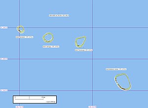
| Map of the Actéon Islands | ||
| Waters | Pacific Ocean | |
| archipelago | Tuamotu Archipelago | |
| Geographical location | 21 ° 23 ′ S , 136 ° 35 ′ W | |
|
|
||
| Number of islands | 4 atolls | |
| Total land area | 8.7 km² | |
| Residents | uninhabited | |
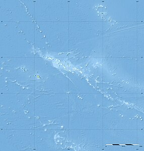
| Location of the Actéon Islands (1) in the Tuamotu Archipelago | ||
The Actéon Islands ( French Îles du groupe Actéon or simply Groupe Actéon ) are a group of islands in the Tuamotu Archipelago in French Polynesia . They are located in the south-easternmost area of the archipelago and administratively already belong to the municipality of Gambier of the Gambier Islands , from which they are about 225 kilometers away.
The archipelago consists of the four atolls Tenararo , Vahanga , Tenarunga and Matureivavao , from west to east . The total land area of the islands is 8.7 km², the area including the lagoons is 38.3 km². None of the four atolls are permanently inhabited.
In 1606, the Portuguese navigator Pedro Fernández de Quirós was the first European to sight the archipelago.
The archipelago is named after the frigate HMS Actaeon of the British captain Lord Edward Russell, who called the group on January 3, 1837. Another name, Amphitrite Islands , comes from AG Findlay, who named it after the ship of the same name owned by the Tahitian pearl merchant Thomas Ebrill . Ebrill, for his part, was out there in 1833.
See also
Web links
- Fauna and flora of the atolls ( Memento of October 18, 2008 in the Internet Archive ) (PDF, 432 kB, English)
Individual evidence
- ↑ Meinicke, Carl Eduard: The Paumotu Archipelago. In: Journal of the Society for Geography in Berlin. Vol. 5; Berlin 1870 (pp. 340-369 & pp. 385-407) here p. 351.


