Alpe Adria Trail
| Alpe Adria Trail | |
|---|---|
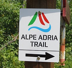
 Signpost on the Alpe Adria Trail |
|
| Data | |
| length | around 750 km |
| Starting point |
Kaiser-Franz-Josefs-Höhe in Carinthia , Austria 47 ° 4 ′ 30 ″ N , 12 ° 45 ′ 4 ″ E |
| Target point |
Muggia on the Adriatic coast in Italy 45 ° 36 ′ 15.3 ″ N , 13 ° 46 ′ 3.5 ″ E |
| Type | Long-distance hiking trail |
The Alpe Adria Trail is a 750 km long mountain hiking trail from the foot of the Grossglockner in Carinthia ( Austria ) via Kranjska Gora ( Slovenia ) to Muggia in Friuli-Venezia Giulia on the Adriatic coast of Italy .
history
The long-distance hiking trail was developed by the tourism associations Carinthia Tourism, Slovenia Tourism and Friuli-Venezia Giulia Tourism and marked throughout 2012. The alpine clubs of the three participating countries ÖAV (Austria), PZS (Slovenia) and CAI (Italy) are responsible for marking and maintaining the trails in the individual countries. It connects existing routes in the border area between Austria, Slovenia and Italy. The new hiking trail is advertised with the slogan Hiking in the Garden of Eden . The hiking trail has been continuously marked with the Alpe Adria Trail symbol.
course
The Alpe-Adria-Trail was not designed as a sporty route, but above all as a cultural route. The 43 stages are usually around 17 km long and can be hiked in 6 hours. Many paths in the non-alpine area lead from place to place on paths steeped in history. At the end of each stage there are usually several places to stop for refreshments and overnight stays.
Austria
The first 21 stages lead the hiker from Kaiser-Franz-Josefs-Höhe below the Großglockner to Baumgartner Höhe above Lake Faak , where you cross the border with Slovenia. On the way you cross the Hohe Tauern National Park and the Nockberge Biosphere Park and hike along several Carinthian lakes ( Millstätter See , Ossiacher See and Wörthersee ).
Slovenia
The next 6 stages of the route lead through Slovenia. From Kranjska Gora you pass through the in the Julian Alps located Triglav National Park , follows the course of the Soca , until you reach the old military paths near Tolmin reached the border with Italy.
Italy
The last stages of the Alpe Adria Trail lead mostly through Italy, with short detours to Slovenia. Cividale del Friuli is reached through the Natisone valley . From there the trail turns south and crosses the Collio wine-growing region , the karst landscape north of Trieste, crosses the border to Slovenia again to stop in Lipica , before the trail ends in Muggia on the Adriatic Sea.
Variant 3-country round tour
In seven day stages it goes from Faaker See in Carinthia via Tarvisio in Friuli-Venezia Giulia and Kranjska Gora in Slovenia back to Austria.
literature
- Astrid Christ, Martin Marktl: Alpe-Adria-Trail: From the Großglockner to Trieste. Rother hiking guide, Munich 2020 (4th edition), ISBN 978-3763344314
- Guido Seyerle: Alpe Adria Trail hiking guide. Bruckmann's hiking guide, Munich 2013, ISBN 978-3765461026 .
Web links
- Official website of the Alpe Adria Trail
- http://www.kaernten.at/de/articles/View/2076
- Info brochure Alpe Adria Trail (PDF; 6.5 MB)
- Map , alpe-adria-trail.com
- Facebook presence
Individual evidence
- ↑ Info brochure Alpe Adria Trail (PDF; 6.5 MB)


