Alsterweiler
|
Alsterweiler
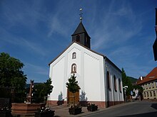
Local church Maikammer
Coordinates: 49 ° 18 ′ 30 ″ N , 8 ° 7 ′ 22 ″ E
|
||
|---|---|---|
| Height : | 202 m above sea level NHN | |
| Residents : | 1345 (June 30, 2007) | |
| Postal code : | 67487 | |
| Area code : | 06321 | |
|
Location of Alsterweiler in Rhineland-Palatinate |
||
Alsterweiler is part of the municipality of Maikammer in the Rhineland-Palatinate district of Südliche Weinstrasse .
location
Alsterweiler is located in the western part of the local community on the eastern edge of the Haardt , which merges into the Weinstrasse region in this area . The Breitenberg extends in the immediate vicinity . Alsterweiler includes, among others, Alsterweiler Hauptstrasse , Friedhofstrasse and Turmstrasse .
history
In the Middle Ages and early modern times, Alsterweiler belonged to the Speyer Monastery .
From 1798 to 1814, when the Palatinate was part of the First French Republic (until 1804) and then part of the First French Empire , Alsterweiler, which at that time already formed a community with the neighboring Maikammer , was incorporated into the canton of Edenkoben . As a result of the agreements made at the Congress of Vienna , the Palatinate came to Austria in June 1815 and to the Kingdom of Bavaria in May 1816 as part of an international exchange treaty . Until 1862 he was part of the Landau's Landkommissariat . In the period that followed, the community was called “Maikammer-Alsterweiler” until 1938.
Population development
In 1824 a total of 2030 people lived on site. In 1928 Alsterweiler had 409 inhabitants, of which 265 were Catholic and 99 Protestant and who lived in 91 residential buildings. In 2007, 1345 people lived on site.
Infrastructure
A Catholic school once existed on site. The town center forms a monument zone. There are also numerous individual monuments on site , including the Alsterweiler Chapel .
traffic
District road 10 , which leads to Diedesfeld , and Kalmithöhenstrasse , which leads into Totenkopfstrasse in the Palatinate Forest, run through Alsterweiler .
Web links
- Alsterweiler on a topographic map from the map service of the landscape information system of the Rhineland-Palatinate nature conservation administration
- Alsterweiler website
Individual evidence
- ↑ a b daten.digitale-sammlungen.de: List of localities for the Free State of Bavaria . Retrieved October 20, 2014 .
- ↑ gov.genealogy.net: Alsterweiler . Retrieved October 20, 2014 .

