Kalmithöhenstrasse
| Kalmithöhenstrasse | ||
|---|---|---|

|
||
| Kalmithöhenstraße above the Wetterkreuzberg | ||
| Length: | about 7.5 km | |
| State : | Rhineland-Palatinate | |
| Region: | Palatinate Forest | |
| Course direction: | East West | |
| Start: | Alsterweiler ( ⊙ ) | |
| The End: | Hüttenhohl ( ⊙ ) | |
| Elevation: | 218 m - 600 m - 476.9 m above sea level NHN | |
|
|
||
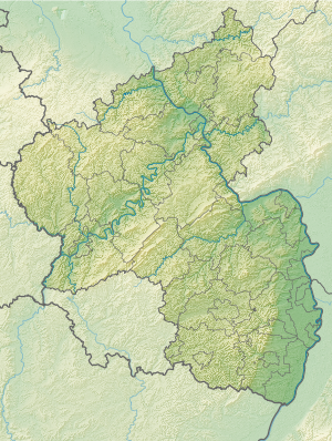
The Kalmithöhenstraße in Haardt , the eastern edge of the Palatinate Forest in Rhineland-Palatinate , is a mountain road in the district of the local community Maikammer . As a 7.5 km long section of the 515 state road , it leads from Alsterweiler , a district of Maikammer, over the Kalmit massif and joins the Totenkopfstraße at the Hüttenhohl pass .
Geographical location
The Kalmithöhenstraße begins at the western exit of Alsterweiler at about 218 m above sea level. NHN and initially follows the Alsterweilerbachtal about 1.5 km west. After a sharp bend , the road initially runs eastwards to go around the Wetterkreuzberg . Then it goes westward between the Kalmitvorgipfeln Breitenberg and Kanzel up to a height of 500 m . After about 3.6 km the road turns south in the direction of Breitenberg, and then runs in a sharp bend north in the direction of the Kalmit summit region. After about 5.6 km the highest point is reached at 600 m ; there branches off ( ⊙ ) a road to the hikers' car park at the Kalmit summit. Further in the direction of the Taubenkopf , the road then runs westwards and descends past the Hahnenschritt pass on the northern slope of the Hüttenberg to the confluence with the Totenkopfstraße at the Hüttenhohl at 476.9 m .
history
The original reason for the plan to expand the unpaved Kalmithöhenstrasse was to improve the tourist development of the Kalmit massif, on which a farmed hut had been located since 1908 . In addition, a large enamel factory in Maikammer had to close in 1928 as a result of the global economic crisis , so that many jobs in the region were lost. The road construction initiated by the municipality of Maikammer was intended to improve the employment situation and was recognized as an emergency measure by the State Labor Office in Munich, which was then responsible for the Palatinate .
The planning and construction management was done free of charge by Privy Councilor Franz Allmaras (Berlin) from Maikammer, who had made a name for himself in construction projects such as the Tanganyika Railway in Tanzania , the Usambara Railway to Kilimanjaro or the Dar es Salaam - Timbuktu desert slope . Construction began in 1930 and was mostly carried out by hand. In 1937 the street could be opened. Today it has been built with an asphalt surface and guardrails . In a few places there are remains of the historical buildings.
tourism
The Kalmithöhenstraße opens up the hiking area on the Kalmit massif for tourists . There are a number of parking spaces for hikers along the way. The ascent to the Kalmit summit can be made from the parking lots at the exit of Alsterweiler via the Alsterweilerbachtal or via the Klausental hut to the Klausental or via St. Martin to the St. Martin valley . From the parking lot below the Wetterkreuzberg a small way of the cross begins to the Maria-Schutz-Kapelle on the summit . Another parking lot is located on the saddle between Stotz and Breitenberg. From the parking lot at Hahnenschritt, a short ascent to the Kalmit summit with the Kalmithaus managed by the Palatinate Forest Association or a hike to the Hohen Loog or to the Hohe Loog Haus is possible.
Web links
- Overview map on LANIS with starting point in Alsterweiler , ending point at the confluence with Totenkopfstraße and the highest point on Kalmit
Individual evidence
- ↑ a b c d Map service of the landscape information system of the Rhineland-Palatinate nature conservation administration (LANIS map) ( notes )
- ↑ Chronicle. Palatinate Forest Association Ludwigshafen-Mannheim, accessed on October 20, 2014 .
- ↑ "The Kalmithöhenstrasse". Maikammer – St. Martin – Kirrweiler, accessed on October 20, 2014 .

