
Wetterkreuzberg
| Wetterkreuzberg | ||
|---|---|---|
 Wetterkreuzberg of Maikammer seen from |
||
| height | 400.7 m above sea level NHN | |
| location | Rhineland-Palatinate , Germany | |
| Mountains | Haardt , Palatinate Forest | |
| Coordinates | 49 ° 18 '45 " N , 8 ° 6' 26" E | |
|
||
| particularities | Maria-Schutz-Chapel | |

The Wetterkreuzberg is 400.7 m above sea level. NHN high mountain the Haardt on the eastern edge of the Palatinate Forest in Rhineland-Palatinate .
geography
location
Like the Breitenberg ( 545.2 m ), the Taubenkopf ( 603.8 m ), the Hüttenberg ( 620.1 m ) or the Kanzel ( 531.7 m ), the Wetterkreuzberg belongs to the foothills of the Kalmit massif ( 672.6 m) ). It is located in an exposed location directly on the edge of the Haardt, so that it can be perceived as a striking mountain despite the relatively low altitude from locations on the Rhine plain. In the north, the mountain is connected to the pulpit by a flat saddle. The Maria-Schutz-Chapel is visible from afar on the summit. The mountain belongs to the Maikammer district .
Natural allocation
The Wetterkreuzberg belongs to the "Palatinate Forest" natural area, which is classified as a 3rd order Greater Region in the systematics of the handbook on the natural structure of Germany published by Emil Meynen and Josef Schmithüsen and its subsequent publications . If you look at the internal structure of the natural area , it belongs to the Middle Palatinate Forest and here to the Haardt mountain range, which separates the Palatinate Forest from the Upper Rhine Plain .
In summary, the natural spatial allocation of the Wetterkreuzberg follows the following system:
- Greater region 1st order: Layer level land on both sides of the Upper Rhine Rift
- Greater region 2nd order: Palatinate-Saarland layer level land
- Greater region 3rd order: Palatinate Forest
- 4th order region (main unit): Middle Palatinate Forest
- 5th order region: Haardt
Maria-Schutz-Chapel
The Weather Cross Chapel was built in 1953. Its construction is the result of a vow made by women from the parish of Maikammer and the prelate Eichenlaub in 1944 as thanks for the protection against possible war destruction. The building was made of sandstone with a slate roof. Every year there is a pilgrimage to the chapel. At the chapel is the weather cross , which was erected in its current form in 1863. According to an inscription on the cross, previous versions must have existed before 1845.
Traffic and walking
The Kalmithöhenstraße , which runs from Maikammer to Hüttenhohl , leads over the mountain . There is a parking lot for hikers just below the summit. The mountain can be reached via hiking trails from the Alsterweiler district of Maikammer , from St. Martin or from the Klausentalhütte .
Picture gallery

Kalmitmassiv seen from Maikammer with Breitenberg, Kalmithauptgipfel, Kanzel and Wetterkreuzberg

Wetterkreuzberg view from the Sommerberg
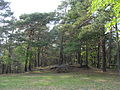
Wetterkreuzberg (summit)

Maria-Schutz-Chapel on the Wetterkreuzberg

Altar of the Maria-Schutz-Chapel on the Wetterkreuzberg

Weather cross


Individual evidence
- ↑ a b LANIS: Wetterkreuzberg on a topographic map from the map service of the landscape information system of the Rhineland-Palatinate nature conservation administration. Retrieved May 16, 2017 .
- ^ Federal Institute for Regional Studies: Geographical Land Survey. The natural space units in single sheets 1: 200,000 . Bad Godesberg 1952–1994. → Online maps * Sheet 160: Landau i. d. Pfalz (Adalbert Pemöller, 1969; 47 p.).
- ↑ Helmut Beeger u. a .: The landscapes of Rheinhessen-Pfalz - naming and spatial delimitation. In: Reports on German regional studies , Volume 63, Issue 2, Trier, 1989, pp. 327–359
- ^ Diocese of Speyer ( Memento from January 27, 2016 in the Internet Archive )