Old Castle (Langenenslingen)
| Old castle | ||
|---|---|---|
| Alternative name (s): | Emerfeld Castle | |
| Castle type : | Höhenburg, spur location | |
| Conservation status: | Wall and moat remains | |
| Place: | Langenenslingen - Emerfeld | |
| Geographical location | 48 ° 9 '46 " N , 9 ° 20' 51" E | |
| Height: | 695 m above sea level NN | |
|
|
||
The old castle , also called Emerfeld Castle , is probably an early Celtic cult and meeting place in the districts of Langenenslingen and Emerfeld , suburbs of the municipality of Langenenslingen in the district of Biberach in Baden-Württemberg .
A research project started in 2014 by the Baden-Württemberg State Office for the Preservation of Monuments could date the construction of the facility to the 8th to 6th centuries BC.
In the past, the old castle was called a defunct castle of uncertain age. The district border Emerfeld / Langenenslingen, which used to be the border between Württemberg and Hohenzollern at the same time, seemed to indicate a medieval context .
location
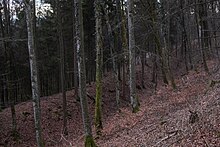
The spur castle is located on an elongated 695 m above sea level. NN high mountain spur of the "Burgberg" 2800 meters northwest of Langenenslingen and consisted of three successively staggered ramparts with ditches in between, the remains of which are still preserved today.
description
Spur surface
The spur surface of the plant is about 500 meters long and about 80 meters wide. It was artificially piled up in parts and thereby flattened. In the longitudinal direction it has an artificial, today still clearly visible terrain step, which is lower in the southeast. The level roughly coincides with the national border mentioned above.
Burial mound
In the south-western part of the spur, a few meters north of the step, lies the so-called burial mound , an elevation made of rubble stones , which was last archaeologically excavated between 2006 and 2007. A five-meter-deep shaft, also known as the sacrificial shaft, was uncovered. In addition to relics from earlier excavations, mainly finds from the late Hallstatt period , a few finds from the early and middle Latène period and human bones were found in the shaft .
Terraces
About 15 meters (northwest) and 20 meters (southeast) below the spur surface, two artificial terraces run along, the width of which is about five to eight meters. The terraces end shortly before the end of the spur or end in the northeast in the slope. They are not part of a defense system and their function is currently unknown.
Dig in front
The entire spur is surrounded in the area of the system about 25 meters (northwest) and about 35 meters (southeast) below the spur surface by a ring trench up to five meters deep with a rampart. The wall trench system is apparently also not integrated into the wall system that separates the facility from the ridge in the northeast.
Main wall
In the northeast, the facility is first separated from the ridge by a 1.5 to 2 meter high wall without a ditch. This is followed by a middle wall, which was heaped up immediately in front of the artificially sunk trench of the main wall. From this trench bottom, the crown of the main wall is up to twelve meters higher. In October 2014, two dry stone walls were uncovered in the area of the main wall during archaeological excavations . They obviously form a corner. The dry stone wall under the main wall has so far been exposed to a height of 4.2 meters. It is therefore the largest structure of its kind north of the Alps from this period. Radiocarbon dating of animal bones on the wall base indicates that the facility was built or used between the 7th and 5th centuries BC.
function
On the one hand, the complex has a clearly defensive character, but on the other hand, it also has less well-secured areas.
The old castle was used at the same time as the Heuneburg near Hundersingen, which lies about nine kilometers east-southeast, and was associated with this early on.
Since it is unlikely that two hilltop settlements of this size are so close to each other, and the human bones found in the sacrificial shaft are very unusual for a settlement, it is assumed that the complex served as a meeting place and place of worship. The extremely unusual rampart supports this interpretation. Excavations have shown that the Große Heuneburg near Upflamör , located about 5 kilometers north-northwest, was built at the same time as the Old Castle and the Heuneburg, i.e. from the 8th to the 6th century BC.
literature
- Markus Dürr: The old castle near Langenenslingen, Biberach district, and the surrounding area. In: Find reports from Baden-Württemberg. Vol. 34, No. 2, 2014, pp. 89–235 ( PDF ; 9.9 MB).
- Leif Hansen , Dirk Krauße : The old castle and its archaeological environment. In: Karl Werner Steim (Ed.): Emerfeld . Federsee-Verlag, Bad Buchau 2015, pp. 10–23.
- Leif Hansen, Roberto Tarpini, Marc Heise, Dirk Krausse, Paul Scherrer: New investigations on the important fortifications Große Heuneburg near Zwiefalten-Upflamör and Alte Burg near Langenenslingen . In: Archaeological excavations in Baden-Württemberg 2016. Theiss 2017, ISBN 978-3-8062-3601-9 , pp. 124–128.
- Leif Hansen, Roberto Tarpini, Elisabeth Stephan, Ralf Hartmayer, Dirk Krausse: The old castle near Langenenslingen: landscape architecture in the Hallstatt period . In: Archaeological excavations in Baden-Württemberg 2017. Theiss 2018, ISBN 978-3-8062-3814-3 , pp. 119–123.
- Siegfried Kurz : Central town and surrounding area. Investigations into the structure of the Heuneburg outlying settlement and the relationship between the Heuneburg and the surrounding hillside settlements. Résumé. May 2005 ( PDF ; 35.6 MB).
- Max Miller (ed.): Handbook of the historical sites of Germany . Volume 6: Baden-Württemberg (= Kröner's pocket edition . Volume 276). Kröner, Stuttgart 1965, DNB 456882928 , p. 375.
- Christoph Morrissey, Dieter Müller: Wall systems in the administrative district of Tübingen . Ed .: Regional Council Stuttgart - State Office for Monument Preservation (= Atlas of archaeological land monuments in Baden-Württemberg . Volume 2/26 ). 1st edition. Konrad Theiss Verlag, Stuttgart 2011, ISBN 978-3-8062-2645-4 , p. 98-129 .
Web links
- Schummerungskarte Source: LGL, www.lgl-bw.de
- Location of the Old Castle, the Heuneburg and the Great Heuneburg Data source: LGL, www.lgl-bw.de
- Press release from January 29th, 2020 by the State Office for Monument Protection BW
- The old castle near Langenenslingen - a Celtic place of worship? State Office for Monument Preservation Baden-Württemberg on YouTube
- The old castle near Langenenslingen - 3D photogrammetry (structure from motion) State Office for Monument Preservation Baden-Württemberg on YouTube
- Early Celtic fortifications discovered. In: SWR Landesschau aktuell. 20th January 2015.
- Celtic fortifications discovered near Langenenslingen. on: Archeology online. 23rd January 2015.
- News from the Celtic fortifications at Langenenslingen. on: Archeology online. May 8, 2015.
Individual evidence
- ↑ a b Alte Burg (desert) on the pages of www.leo-bw.de (regional information system for Baden-Württemberg)
- ↑ a b Press release from January 29, 2020 by the State Office for Monument Protection BW
- ^ A b c d Christoph Morrissey, Dieter Müller: Wall systems in the administrative district of Tübingen . Ed .: Regional Council Stuttgart - State Office for Monument Preservation (= Atlas of archaeological land monuments in Baden-Württemberg . Volume 2/26 ). 1st edition. Konrad Theiss Verlag, Stuttgart 2011, ISBN 978-3-8062-2645-4 , p. 98-129 .
- ^ A b c Leif Hansen, Dirk Krausse: Mighty neighbors of the Heuneburg . In: Archeology in Germany . No. 2 , 2015, p. 4 .


