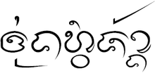
Thung Hua Chang district
|
Thung Hua Chang ทุ่งหัวช้าง |
|
|---|---|
| Province: | Lamphun |
| Surface: | 486.1 km² |
| Residents: | 19,899 (2013) |
| Population density : | 39.2 U / km² |
| ZIP : | 51160 |
| Geocode : | 5105 |
| map | |

|
|

Amphoe Thung Hua Chang ( Thai อำเภอ ทุ่งหัวช้าง , pronunciation: ʔāmpʰɤ̄ː tʰûŋ hǔa tɕʰáːŋ ) is a district ( Amphoe - administrative district) in the east of Lamphun Province . The Lamphun Province is located in the northern region of Thailand .
geography
Neighboring counties (clockwise from west): Amphoe Li , Ban Hong and Mae Tha of Lamphun Province, and Soem Ngam and Thoen of Lampang Province .
history
Ban Hong was on 1 February 1987 as "branch circuit" ( King Amphoe ) established, consisting of three tambon which the county Li were split. On November 4, 1993, the subdistrict was given full amphoe status.
administration
Provincial Administration
Thung Hua Chang County is divided into three tambon ("subdistricts" or "parishes"), which are further divided into 35 muban ("villages").
| No. | Surname | Thai | Muban | Pop. |
|---|---|---|---|---|
| 1. | Thung Hua Chang | ทุ่งหัวช้าง | 12 | 8,859 |
| 2. | Ban Puang | บ้าน ปวง | 11 | 4,103 |
| 3. | Takhian Pom | ตะเคียน ป ม | 12 | 6,937 |
Local administration
There is one municipality with "small town" status ( Thesaban Tambon ) in the district:
- Thung Hua Chang (Thai: เทศบาล ตำบล ทุ่งหัวช้าง ) consisting of parts of the tambon Thung Hua Chang.
There are also three " tambon administration organizations " ( องค์การ บริหาร ส่วน ตำบล - Tambon Administrative Organizations, TAO)
- Thung Hua Chang (Thai: องค์การ บริหาร ส่วน ตำบล ทุ่งหัวช้าง ) consisting of parts of the Tambon Thung Hua Chang.
- Ban Puang (Thai: องค์การ บริหารส่วน ตำบล บ้าน ปวง ) consisting of the complete tambon Ban Puang.
- Takhian Pom (Thai: องค์การ บริหาร ส่วน ตำบล ตะเคียน ป ม ) consisting of the complete tambon Takhian Pom.
Individual evidence
- ↑ ประกาศ กระทรวง มหาดไทย เรื่อง แบ่ง ท้องที่ อำเภอ ลี้ จังหวัด ลำพูน ตั้ง เป็น กิ่ง อำเภอ ทุ่งหัวช้าง . In: Royal Gazette . 94, No. 11 ง , February 8, 1987, p. 488.
- ↑ พระราชกฤษฎีกา ตั้ง อำเภอ ลำ ทับ อำเภอ ร่องคำ อำเภอ เวียง แหง อำเภอ นา โยง อำเภอ แก้ง สนาม นาง อำเภอ โนน แดง อำเภอ บ้านหลวง อำเภอ กะพ้อ อำเภอ ศรี บรรพต บรรพต อำเภอ แก่ง กระจาน อำเภอ อำเภอ หนอง สูง อำเภอ สบ เมย อำเภอ เมย วดี อำเภอ โคก เจริญ อำเภอ ทุ่งหัวช้าง อำเภอ วัง ขาว ขาว ขาว ขาว ขาว ขาว หิน อำเภอ ดอนพุด อำเภอ บึง โขง หลง และ อำเภอ ห้วย ค ต พ.ศ. ๒๕๓๖ . In: Royal Gazette . 110, No. 179 ก ฉบับ พิเศษ (special), November 3, 1993, pp. 1-3.
- ↑ 2013 population statistics ( Thai ) Department of Provincial Administration. Retrieved October 27, 2014.
Web links
Coordinates: 18 ° 0 ' N , 99 ° 2' E
