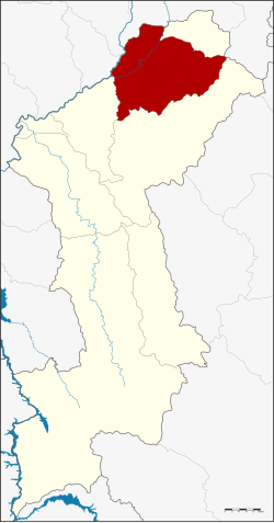
Amphoe Mueang Lamphun
|
Mueang Lamphun เมือง ลำพูน |
|
|---|---|
| Province: | Lamphun |
| Surface: | 479.8 km² |
| Residents: | 144,406 (2013) |
| Population density : | 292.8 U / km² |
| ZIP : | 51000, 51150 |
| Geocode : | 5101 |
| map | |

|
|

Amphoe Mueang Lamphun (in Thai : อำเภอ เมือง ลำพูน , pronunciation: ʔāmpʰɤ̄ː mɯ̄aŋ lām.pʰūːn ) is a district ( amphoe - administrative district) in the province of Lamphun . The Lamphun Province is located in the northern region of Thailand .
geography
Neighboring counties (clockwise from the south): Mae Tha and Pa Sang in Lamphun Province, San Pa Tong , Hang Dong , Saraphi in Chiang Mai Province , Ban Thi again in Lamphun and Mae On again in Chiang Mai.
The main water resource in the county is the Mae Nam Ping (Ping River) .
administration
Provincial Administration
Mueang Lamphun County is divided into 15 tambon ("subdistricts" or "parishes"), which are further subdivided into 159 muban ("villages").
| No. | Surname | Thai | Muban | Pop. |
|---|---|---|---|---|
| 1. | Nai Mueang | ใน เมือง | - | 12,733 |
| 2. | Mueang Nga | เหมือง ง่า | 10 | 15,652 |
| 3. | Umong | อุโมงค์ | 11 | 13,262 |
| 4th | Nong Chang Khuen | หนอง ช้าง คืน | 6th | 3,761 |
| 5. | Pratu Pa | ประตูป่า | 9 | 5,572 |
| 6th | Rim ping | ริม ปิ ง | 10 | 6,930 |
| 7th | Clay thong | ต้น ธง | 11 | 12,753 |
| 8th. | Ban Paen | บ้าน แป้น | 9 | 6,108 |
| 9. | Mueang Chi | เหมือง จี้ | 14th | 8,911 |
| 10. | Pa Sak | ป่า สัก | 18th | 13,469 |
| 11. | Wiang Yong | เวียง ยอง | 8th | 6.176 |
| 12. | Ban sound | บ้าน กลาง | 12 | 9,957 |
| 13. | Makhuea Chae | มะเขือ แจ้ | 21st | 15,536 |
| 16. | Si Bua Ban | ศรี บัว บาน | 12 | 8,739 |
| 17th | Nong Nam | หนอง หนาม | 8th | 4,847 |
Local administration
There is one commune with "city" status ( Thesaban Mueang ) in the district:
- Lamphun (Thai: เทศบาล เมือง ลำพูน ) consisting of the complete Tambon Nai Mueang.
There are 13 municipalities with "small town" status ( Thesaban Tambon ) in the district:
- Nong Chang Khuen (Thai: เทศบาล ตำบล หนอง ช้าง คืน ) consisting of the complete Tambon Nong Chang Khuen.
- Pratu Pa (Thai: เทศบาล ตำบล ประตูป่า ) consisting of the complete Tambon Pratu Pa.
- Clay thong (Thai: เทศบาล ตำบล ต้น ธง ) consisting of the complete tambon clay thong.
- Tha Chiang Thong (Thai: เทศบาล ตำบล ท่า เชียง ทอง ) consisting of parts of the Tambon Ban Paen.
- Mueang Chi (Thai: เทศบาล ตำบล เหมือง จี้ ) consisting of the complete tambon Mueang Chi.
- Si Bua Ban (Thai: เทศบาล ตำบล ศรี บัว บาน ) consisting of the complete tambon Si Bua Ban.
- Ban Paen (Thai: เทศบาล ตำบล บ้าน แป้น ) consisting of the parts of the tambon Ban Paen, Nong Nam.
- Rim ping (Thai: เทศบาล ตำบล ริม ปิ ง ) consisting of the complete tambon rim ping.
- Umong (Thai: เทศบาล ตำบล อุโมงค์ ) consisting of the complete tambon umong.
- Mueang Nga (Thai: เทศบาล ตำบล เหมือง ง่า ) consisting of the complete tambon Mueang Nga.
- Ban Klang (Thai: เทศบาล ตำบล บ้าน กลาง ) consisting of the complete Tambon Ban Klang.
- Wiang Yong (Thai: เทศบาล ตำบล เวียง ยอง ) consisting of the complete tambon Wiang Yong.
- Makhuea Chae (Thai: เทศบาล ตำบล มะเขือ แจ้ ) consisting of the complete tambon Makhuea Chae.
There are also two " tambon administration organizations " ( องค์การ บริหาร ส่วน ตำบล - Tambon Administrative Organizations, TAO)
- Pa Sak (Thai: องค์การ บริหาร ส่วน ตำบล ป่า สัก ) consisting of the complete tambon Pa Sak.
- Nong Nam (Thai: องค์การ บริหาร ส่วน ตำบล หนอง หนาม ) consisting of parts of the Tambon Nong Nam.
Individual evidence
- ↑ 2013 population statistics ( Thai ) Department of Provincial Administration. Retrieved October 27, 2014.
Web links
- More information on Amphoe Mueang Lamphun from amphoe.com (in Thai)
- Changwat Lamphun - Provincial Administration Page (in English and Thai)
Coordinates: 18 ° 35 ' N , 99 ° 1' E
