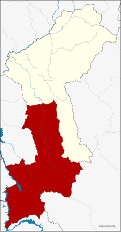
Amphoe Li
|
Li ลี้ |
|
|---|---|
| Province: | Lamphun |
| Surface: | 1701.99 km² |
| Residents: | 69,151 (2013) |
| Population density : | 39.5 U / km² |
| ZIP : | 51110 |
| Geocode : | 5104 |
| map | |

|
|

Amphoe Li ( Thai อำเภอ ลี้ , pronunciation: ʔāmpʰɤ̄ː líː ) is the southernmost district ( Amphoe - administrative district) of Lamphun Province . The Lamphun Province is located in the northern region of Thailand .
geography
Neighboring counties (clockwise from north): Ban Hong and Thung Hua Chang Amphoe of Lamphun Province, Soem Ngam , Thoen and Mae Phrik of Lampang Province , Sam Ngao of Tak Province , and Doi Tao , Hot and Chom Thong of Chiang Mai Province .
The western border of the district is formed by the Mae Nam Ping (Ping River) . Parts of the 1003 km² Mae Ping National Park are located in the south of the district. The park stretches from Amphoe Doi Tao of Chiang Mai Province , Li through to Amphoe Sam Ngao in the province of Tak . There are numerous waterfalls and a few caves to explore in the park.
history
Li County was established in 1911. It was originally called Mueang Li, but was shortened to Li in 1917.
administration
Provincial Administration
Li County is divided into eight tambon ("subdistricts" or "parishes"), which are further subdivided into 99 muban ("villages").
| No. | Surname | Thai | Muban | Pop. |
|---|---|---|---|---|
| 1. | Li | ลี้ | 17th | 13,728 |
| 2. | Mae Tuen | แม่ ตื น | 17th | 11,236 |
| 3. | Well Sai | นา ทราย | 23 | 18,479 |
| 4th | Dong Dam | ดง ดำ | 6th | 3.139 |
| 5. | Ko | ก้อ | 4th | 2,444 |
| 6th | Mae Lan | แม่ ลาน | 7th | 3,080 |
| 8th. | Pa Phai | ป่า ไผ่ | 12 | 9,428 |
| 9. | Si Wichai | ศรี วิชัย | 13 | 7,617 |
Local administration
There are seven municipalities with "small town" status ( Thesaban Tambon ) in the district:
- Li (Thai: เทศบาล ตำบล ลี้ ) consisting of parts of the tambon Li.
- Dong Dam (Thai: เทศบาล ตำบล ดง ดำ ) consisting of the complete Tambon Dong Dam.
- Ko (Thai: เทศบาล ตำบล ก้อ ) consisting of the complete tambon Ko.
- Pa Phai (Thai: เทศบาล ตำบล ป่า ไผ่ ) consisting of the complete tambon Pa Phai.
- Mae Tuen (Thai: เทศบาล ตำบล แม่ ตื น ) consisting of parts of the Tambon Mae Tuen.
- Wang Din (Thai: เทศบาล ตำบล วัง ดิน ) consisting of parts of the Tambon Li.
- Si Wichai (Thai: เทศบาล ตำบล ศรี วิชัย ) consisting of the complete tambon Si Wichai.
There are also three " tambon administration organizations " ( องค์การ บริหาร ส่วน ตำบล - Tambon Administrative Organizations, TAO)
- Wiang Kaeo (Thai: องค์การ บริหาร ส่วน ตำบล เวียง แก้ว ) consisting of parts of the Tambon Mae Tuen.
- Na Sai (Thai: องค์การ บริหาร ส่วน ตำบล นา ทราย ) consisting of the complete Tambon Na Sai.
- Mae Lan (Thai: องค์การ บริหาร ส่วน ตำบล แม่ ลาน ) consisting of the complete Tambon Mae Lan.
Individual evidence
- ↑ ประกาศ กระทรวง มหาดไทย เรื่อง เปลี่ยน ชื่อ อำเภอ . In: Royal Gazette . 34, No. 0 ก , April 29 1917, pp. 40-68.
- ↑ 2013 population statistics ( Thai ) Department of Provincial Administration. Retrieved October 27, 2014.
Web links
- More information about Amphoe Li from amphoe.com (in Thai)
- Official website of the Mae-Ping_National Park (English)
Coordinates: 17 ° 48 ' N , 98 ° 57' E
