Ansonia (Connecticut)
| Ansonia | ||
|---|---|---|
| Nickname : Copper City | ||
 Church in Ansonia |
||
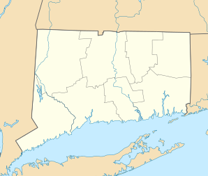
| Location in Connecticut | ||
|
|
||
| Basic data | ||
| Foundation : | 1652 | |
| State : | United States | |
| State : | Connecticut | |
| County : | New Haven County | |
| Coordinates : | 41 ° 21 ′ N , 73 ° 4 ′ W | |
| Time zone : | Eastern ( UTC − 5 / −4 ) | |
| Residents : | 19,158 (as of 2012) | |
| Population density : | 1,228.1 inhabitants per km 2 | |
| Area : | 16.1 km 2 (approx. 6 mi 2 ) of which 15.6 km 2 (approx. 6 mi 2 ) is land |
|
| Height : | 25 m | |
| Postal code : | 06401 | |
| Area code : | +1 203 | |
| FIPS : | 09-01150 | |
| GNIS ID : | 0205107 | |
| Website : | www.munic.state.ct.us/ANSONIA/ansonia.htm | |
| Mayor : | James T. Della Volpe | |
Ansonia is a city in New Haven County in the US state of Connecticut . The city lies on the Naugatuck River .
history
Ansonia was founded in 1652 and named after Anson Greene Phelps , a philanthropist . Originally, Ansonia was part of Derby . The city suffered massive destruction on August 19, 1955 by Hurricane Diane. In the decades following the hurricane, Ansonia experienced a recession . In recent years the economy has recovered after a few new stores opened.
schools
- John G. Prendergast School
- John C. Mead School
- Ansonia Middle School
- Ansonia High School
Population development and demographics
|
|
|
According to the 2000 census, Ansonia had 18,554 residents spread across 7,507 households. The population density was 1,188 inhabitants / km². 85.52% of the population were white, 8.42% were African American, and 7.42% were Latinos.
sons and daughters of the town
- Franklin Farrell (1908-2003), ice hockey goalkeeper
- Reuben H. Tucker (1911-1970), two-star general
- Samuel Jaskilka (1919–2012), 4-star general
- Allen Tinney (1921-2002), jazz pianist
- John Cooke (1937-2005), rower
- Sandy Osiecki (born 1960), American football player
- Mayumi Roller (* 1991), sailor
Individual evidence
- ↑ Who's Who in Marine Corps History - General Samuel Jaskilka, USMC , tecom.usmc.mil
- ↑ John Cooke in the database of Sports-Reference (English)
