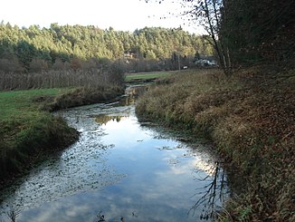
Bachmühlbach
| Bachmühlbach | ||
|
The Bachmühlbach at the Bachmühlbachquelle |
||
| Data | ||
| Water code | EN : 13988 | |
| location | Germany , Bavaria | |
| River system | Danube | |
| Drain over | Black Laber → Danube → Black Sea | |
| source | west of the Bachmühle 49 ° 1 ′ 48 ″ N , 11 ° 52 ′ 45 ″ E |
|
| Source height | 400 m above sea level NN | |
| Spring discharge |
MQ |
100 l / s |
| muzzle | at the Deuerling barrage in the Schwarze Laber Coordinates: 49 ° 2 ′ 8 ″ N , 11 ° 54 ′ 3 ″ E 49 ° 2 ′ 8 ″ N , 11 ° 54 ′ 3 ″ E |
|
| Mouth height | 390 m above sea level NN | |
| Height difference | 10 m | |
| Bottom slope | 5.1 ‰ | |
| length | 2 km (with periodic upper reaches 9.76 km) | |
The Bachmühlbach is a 9.8 km long right tributary of the Schwarzen Laber in the Franconian Alb in Bavaria .
geography
course
The periodic upper course of the Bachmühlbach begins in Painten in Lower Bavaria , then runs through the Painten Valley across the border with the Upper Palatinate and is only fed with water all year round after about 7.8 km from the Bachmühlbach spring.
It flows very slowly directly after the karst spring and is immediately several meters wide. It runs in a north-easterly direction and passes under the St 2660 at Neudeuerling . There the Bachmühlbach flows into the Schwarze Laber at the Deuerling barrage .
Bachmühlbachquelle
The Bachmühlbachquelle is located west of the Bachmühle. The water of the karst spring rises from several spring funnels. It has been designated as a natural monument. To ensure this, the protection also extends to the immediate vicinity. The extremely constant pouring averages around 100 l / s.
The source is identified by the Bavarian State Office for the Environment as geotope 375Q001. See also the list of geotopes in the Regensburg district .
Web links
- The Bachmühlbach spring (PDF; 157 kB)
Individual evidence
- ↑ a b Google Earth
- ↑ GeoFachDatenAtlas and water services of the Bavarian State Office for the Environment
- ↑ Overall table of the Bavarian water directory of the Bavarian State Office for the Environment (XLS, 10.3 MB)
- ↑ Geotope: Bachmühlbachquellen near Bachmühle (accessed on September 4, 2013; PDF; 157 kB)

