Barchembach
| Barchembach | ||
|
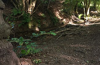
In the Siepen of the Barchembach |
||
| Data | ||
| Water code | DE : 2772914 | |
| location |
Westphalian Bay
|
|
| River system | Rhine | |
| Drain over | Alter Pausmühlenbach → Emscher → Rhine → North Sea | |
| source | in food - Bedingrade below the Barchemhöhe 51 ° 28 '27 " N , 6 ° 55' 16" O |
|
| Source height | approx. 84 m above sea level NN | |
| muzzle | in food- Dellwig in the elderly Pausmühlenbach coordinates: 51 ° 29 '35 " N , 6 ° 55' 47" O 51 ° 29 '35 " N , 6 ° 55' 47" O |
|
| Mouth height | approx. 39 m above sea level NN | |
| Height difference | approx. 45 m | |
| Bottom slope | approx. 17 ‰ | |
| length | approx. 2.7 km | |
| Catchment area | 3.9 km² | |
The Barchembach is a left tributary of the Old Pausmühlenbach in Essen in the Emscher river system .
course
The Barchembach rises above the Essen district of Dellwig in the Bedingrade district on the northern edge of the Westenhellweg . The source is at a height of around 84 meters.
The Siepen is close to nature crossed by the run-in of the stream. The valley has a southwest-northeast course. In the upper part of the Siepen there is a dense population of trees. You will mainly find black alder , in between ash trees , occasional willows , and beeches and maples on the relatively steep slopes .
In the lower area of the source valley, just before it opens towards the Emscher lowland, the slopes are less steep. On the eastern side in particular, the terrain slopes gently towards the stream. The Dellwig settlement was established there in the Middle Ages. The Siepe, the valley pasture by the stream, is still used to keep horses today. The Barchembach valley is criss-crossed by walking and cycling paths.
Shortly before reaching the north lying Emscher valley the creek is fed underground from the settlement on Görtzpfad. To the north of the Cologne-Mindener railway line , it reappears west of the Brömse courtyard and flows east of the courtyard into the Pausmühlenbach via canals.
Individual evidence
- ^ Karlheinz Paffen , Adolf Schüttler, Heinrich Müller-Miny: Geographical land survey: The natural space units on sheet 108/109 Düsseldorf / Erkelenz. Federal Institute for Regional Studies, Bad Godesberg 1963. → Online map (PDF; 7.1 MB)
- ↑ a b GeoServer NRW, District Government Cologne, Department GEObasis NRW
- ↑ Designation according to DGK5 floor plan .

