Bedanda
| Bedanda | ||
|---|---|---|
|
|
||
| Coordinates | 11 ° 21 ′ N , 15 ° 7 ′ W | |
| Basic data | ||
| Country | Guinea-Bissau | |
| Sul | ||
| region | Tombali | |
| ISO 3166-2 | GW-TO | |
| surface | 1,142.6 km² | |
| Residents | 24,293 (2009) | |
| density | 21.3 Ew. / km² | |
|
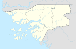
Location of the Bedanda sector in the Tombali administrative region
|
||
Bedanda is a small town in southwest Guinea-Bissau with 665 inhabitants (as of 2009).
The place is the seat of the sector of the same name with an area of 1142 km² and 24,293 inhabitants (as of 2009), mainly Balanta with significant minorities of Fulbe and Mandinka .
In the Bedanda sector lies the Cubucaré peninsula , which makes up an essential part of the Parque Nacional de Cantanhez . The Cantanhez National Park is the last largely intact jungle in Guinea-Bissau.
history
During the Portuguese colonial war , which lasted from 1963 to 1974 in Guinea-Bissau and was particularly intense there, the area of today's Bedanda sector was the scene of mutual commandos and sieges several times . The town of Guiledje or Guileje, where a contested base of the Portuguese armed forces existed and which could be captured by the independence movement PAIGC in May 1973, became particularly well known .
In March 1974, the PAIGC independence movement attacked the heavily fortified Portuguese military camp of Bedanda, initially with a 24-hour bombardment of 122 mm rockets, then for the first time with heavy artillery mounted on vehicles. The Portuguese unit was able to hold its position, albeit with difficulty. This was the penultimate battle of the Portuguese armed forces in Portuguese Guinea. After the Carnation Revolution in Portugal on April 25, 1974, the new government ended the colonial wars and recognized Guinea-Bissau's independence on September 10, 1974.
The Guiledje Museum
In the former military camp of Guiledje, the Museu da Independência da Guiné-Bissau is now set up, which deals with this episode and shows weapons, ammunition, photos, maps and documents. A former resistance fighter leads visitors through the exhibition, which is now dedicated to peace.
structure
The small town of Bedanda is the capital of the eponymous sector, which comprises a total of 40 localities on the mainland and three localities on the island of Melo, predominantly rural villages ( Tabancas ). The most important localities include:
- Amdalai (518 inhabitants)
- Bedanda (665 inhabitants)
- Cabedú (Quartel) (857 inhabitants)
- Caboxanque (2168 inhabitants in three districts)
- Cadique Iala (718 inhabitants)
- Cafal Balanta (492 inhabitants)
- Cafine (903 inhabitants)
- Catesse (536 inhabitants)
- Cura (443 inhabitants)
- Darssalame I (701 inhabitants)
- Iemberem (992 inhabitants)
- Incalá (601 inhabitants)
- Sintchã Botche (Guiledje Cruzamento) (730 inhabitants)
- Melo Island (488 inhabitants in three villages)
Web links
Individual evidence
- ↑ a b c Inhabitants by region, sector and town by gender, 2009 census (p. 5ff), PDF retrieval from the National Statistics Office INE of December 15, 2017
- ↑ Annual Statistical Report Guinea-Bissau 2015 (p. 10), PDF available from the National Statistics Office INE on December 13, 2017
- ^ Francisco Henriques da Silva, Mário Beja Santos: Da Guiné Portuguesa à Guiné-Bissau. Fronteira do Caos Editores, Porto 2014 ISBN 978-989-8647-18-4 , p. 135
- ↑ Joana Petrolho, Marta Rosa: À Descoberta da Guiné-Bissau . , Afectos com Letras / EU , Pombal 2015, ISBN 978-989-20-6252-5 , p. 96

