
Benther Mountain Terraces


The Benther Berg-Terrassen were a restaurant and an excursion restaurant near Benthe in Lower Saxony . The catering business went back to a beverage stand built around 1860 on Benther Berg under the name Erichs Ruh . The Benther Berg-Terrassen have long been one of the most attractive excursion destinations in the Hanover area , as well as the Berggasthaus Niedersachsen and the Waldschlösschen on the Gehrdener Berg . After the decline in the 1970s, it was closed in 1974 and destroyed by a fire in 1975.
history

As early as 1558 there was a "Krug" in Benthe, which was later called "Alter Dorfkrug". In the 19th century the "Gatsstätte Sieben Trappen", a stop for stagecoaches, was created. A natural stone path leads from the village of Benthe up to Benther Berg, which is said to date from the 18th century. Around 1860, Ernst Rehbock opened a drinks stand on the way in the vicinity of a picnic area of the Hanoverian Princely Society. In 1879 he built his house there with guest rooms and a hall. The restaurant was named Erichs Ruh , which was based on an agreement in the lease with the landowner Erich von Lenthe . Due to the increasing number of visitors, the guest rooms were extended by a glass veranda in 1894. The Benther Berg developed into a popular excursion destination at the end of the 19th century, especially for residents from the western areas of the nearby city of Hanover . The journey made easier by the overland route of the Hannoversche Straßenbahn AG in the direction of Gehrden , which was established in 1896 and ran through the Benther district of Sieben Trappen. In 1913, Christian Rehbock, the founder's son and heir, had an extension built. From 1925 he leased Erichs Ruh and in 1929 it was sold. He was succeeded by the Hanoverian innkeeper Ernst Werner, who significantly increased the number of seats through renovations and built a dance floor illuminated from below.
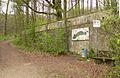
In the Second World War , Erichs Ruh became a military hospital from 1943 . Because of the increasing air strikes, miners from the nearby Empelde potash plant drove a tunnel into the mountain under the restaurant parking lot . In the event of an air raid, it served as an air raid shelter for the patients and the hospital staff. After the war ended, the British military government set up a home in the building for orphans of displaced persons . After the restaurant reopened in 1948, excursion traffic resumed at an earlier rate, albeit with symptoms of shortages due to the consequences of the war. During this time, the name was changed to Benther Berg-Terrassen , which had 1,500 seats outdoors and around 750 seats inside. Many family celebrations and weddings were celebrated on the Benther Berg. After a further upswing in the 1950s and 1960s, including visitors to the Hanover Fair , the number of guests fell in the 1970s and the decline followed. In 1974 it was closed and the building was offered for sale. During this time, the vacant building was affected by vandalism and several times by fire. At the end of 1975 a fire set by strangers destroyed the Benther Berg-Terrassen, despite the fire brigade deploying the fire. It was not until 1989 that the fire ruins were leveled. To this day (2017) there are extensive building remains, such as retaining walls and stairs, on the site under the forest.
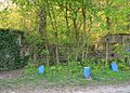
Overgrown staircase to the restaurant, in front of it blue color markings of the green ring

The staircase from the inside

Ruins of the interior
Retaining wall on the slope with the weathered logo of the brewery guild

Facade wall with windows and circular arches


Web links
- Detailed description of the Benther Berg Terraces
- Anne Grüneberg: Remembrance of the Benther Berg-Terrassen in Hannoversche Allgemeine Zeitung from May 15, 2014
Individual evidence
- ^ Otto Bertram, Hermann Deiters, Hans-Erich Wilhelm: Contributions to the chronicle of the village Benthe . Ronnenberg 1990, p. 275 .
- ^ A b Hans-Hermann Fricke: Beginning of the industrial age . In: Peter Hertel et al. (Ed.): Ronnenberg. Seven Traditions - One City . Ronnenberg 2010, ISBN 978-3-00-030253-4 , pp. 106 f .
- ^ Chronicle of the Benthe Volunteer Fire Brigade
Coordinates: 52 ° 20 ′ 25.5 ″ N , 9 ° 37 ′ 20.5 ″ E