Mountain climb
Bergsteig is a hamlet about two kilometers southwest of Fridingen an der Donau , to which it also belongs.
location
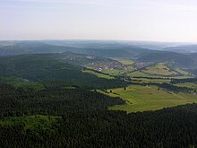
Bergsteig is a pass between the Danube Valley in Fridingen and the Kessel or the valley to Neuhausen ob Eck . In the west of it the Welschenberg rises towards Mühlheim an der Donau and in the east the high plateau of the Heuberg towards Buchheim . Today's depression and the short section of elevation come from the original Danube , which flowed from Mühlheim through the basin and over a mountain path to Beuron . The Neuhauser Tal with the boiler as an extension drain westwards to Mühlheim.
Bergsteig consists of a house and two restaurants .
The name "Bergsteig" is a combination of mountain and steep path .
traffic
Bergsteig is a traffic junction : The L 440 from Balingen to Eigeltingen to Neuhausen and the K 5940 from Fridingen to Buchheim branch off from the L 277, which leads from Tuttlingen to Riedlingen and connects Fridingen with Mühlheim. The Tuttlingen – Inzigkofen railway line and the Danube Cycle Path , on the other hand, take the roughly equally long route through the Danube Valley on this connection .
There are also direct dirt roads from Bergsteig to the Dickenloch residential area in Fridingen , to the Maria Hilf pilgrimage church in Mühlheim on the Welschenberg and to Nendingen via the Halldorfer Weg .
Bergsteig is integrated into the public transport network via the hourly bus line 50 in the direction of Fridingen / Sigmaringen and Mühlheim / Tuttlingen. Bus line 20 also runs on weekdays, connecting Fridingen, the Dickenloch and Bergsteig with Buchheim, Worndorf, Schwandorf and Neuhausen. There is also a large parking lot for hikers, at which there is also a transfer stop between bus lines 50 and 20, but which is rarely used.
Coordinates: 48 ° 0 '28.08 " N , 8 ° 54' 59.76" O
