
Buchheim (Tuttlingen district)
| coat of arms | Germany map | |
|---|---|---|

|
Coordinates: 48 ° 1 ′ N , 8 ° 59 ′ E |
|
| Basic data | ||
| State : | Baden-Württemberg | |
| Administrative region : | Freiburg | |
| County : | Tuttlingen | |
| Local government association: | Danube Heuberg | |
| Height : | 793 m above sea level NHN | |
| Area : | 18.3 km 2 | |
| Residents: | 683 (December 31, 2018) | |
| Population density : | 37 inhabitants per km 2 | |
| Postcodes : | 88637, 78567 | |
| Area code : | 07777 | |
| License plate : | DOES | |
| Community key : | 08 3 27 008 | |
| Address of the municipal administration: |
Rathausstrasse 4 88637 Buchheim |
|
| Website : | ||
| Mayor : | Claudette Koelzow | |
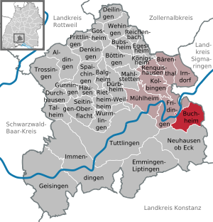
| Location of the municipality of Buchheim in the Tuttlingen district | ||
  |
||


Buchheim is a municipality in the district of Tuttlingen in Baden-Württemberg , Germany .
geography
Location and geology
Buchheim is about 800 meters above sea level on the Hegaualb . This southwestern part of the Swabian Alb is already south of the Danube , but geologically corresponds to the Great Heuberg in the north. In between - at Fridingen and Buchheim - the Danube breakthrough runs through the Swabian Alb. The entire area belongs to the Upper Danube Nature Park .
The community has a fishing water right on the Danube.
Neighboring communities
The community borders Beuron in the north and Leibertingen in the east , both in the Sigmaringen district , Neuhausen ob Eck in the south and Fridingen an der Donau in the west .
Community structure
The municipality of Buchheim includes the village of Buchheim, the Gründelbuch (Schäferhof), Hilbenhof, Scheuerlehof and Vorderer Jakobenhof farms and the Kiesgruben houses. The Kallenberg castle ruins and the Ozenswilare desert are in the municipality.
history

Excavation remains from the Stone Age are evidence of the first settlement from prehistoric times.
The place Buchheim was first mentioned as Puachheim in 861 in a document from the St. Gallen monastery .
Various ecclesiastical and secular rulers owned the place. Buchheim has three different previous state responsibilities. Up until the last century there were three districts there, namely Buchheim, Gründelbuch and Kallenberg.
The place Buchheim itself belonged since 1409 to the rule Mühlheim-Bronnen belonging to the barons of Enzberg , who also held the lower jurisdiction . The counties Sigmaringen and Nellenburg shared the jurisdiction . The Thirty Years' War (1618–1648) brought great misery , during which the entire village and the tower with the parish church were set on fire by passing Saxon troops at the beginning of June 1677. The citizens of Buchheim carried out the labor service for the Lords of Enzberg ; this was abolished by law. They had to buy back 300 hectares of community forest and 150 hectares of Allmendfeld from the Lords of Enzberg for twenty times as much. During the secularization of 1805 the transition to Württemberg took place in 1806 , but in 1810 Buchheim came to Baden and thus to the district of Meßkirch . In 1900 the construction of a pipeline network for the water supply began.
Gründelbuch with Jakobenhof, Hilbenhof and Schäferhof was Salemian property and was a so-called "subsidiary community" under the administration of the Salemic Obervogteiamt Münchhöf. Even after the transition to Baden, Gründelbuch was still part of the Münchhöf community before it finally came to Buchheim in 1925.
The ruins of the castle of the same name and the Scheuerlehof on the Danube are the only structures that have survived from the former Kallenberg rulership , which was also once an independent district . In 1772 the rule of Kallenberg came to the barons of Ulm-Erbach as a Habsburg fiefdom of the County of Hohenberg , became part of Württemberg temporarily in 1806 and came to Baden in 1810 together with Buchheim. It was not until 1924 that the Kallenberg district was merged with that of Buchheim. The villages of Nusplingen , Obernheim , Dormettingen , Erlaheim and Bronnhaupten , all of which became part of Württemberg in 1806, also belonged to the former rule of Kallenberg .
In 1936 the office of Meßkirch was dissolved and its communities were incorporated into the Stockach office. This resulted in the Stockach district in 1939 . During the district reform of Baden-Württemberg in 1973 , the Stockach district was dissolved; the municipality Buchheim was assigned to the district of Tuttlingen with effect from January 1, 1973.
politics
Administrative association
The community is a member of the community administration association Donau-Heuberg , based in Fridingen an der Donau .
Municipal council
The local elections on May 25, 2014 led to the following official final result. The turnout was 71.7% (2009: 73.4%). The municipal council consists of the elected voluntary councilors and the mayor as chairman. The mayor is entitled to vote in the municipal council.
| Party / list | Share of votes | Seats | Result 2009 |
| Free voters | 55.0% | 4th | 50.9%, 4 seats |
| CDU | 45.0% | 4th | 49.1%, 4 seats |
mayor
- 1977 to 2017: Hans-Peter Fritz (* 1952 in Buchheim), restaurateur
- since 2017: Claudette Kölzow
coat of arms
|
|
Blazon : "In silver on green ground, a red tower surrounded by a red wall." |
Culture and sights
The municipality is affiliated with the "Donaubergland" tourist association.
Buildings


- The Buchheimer Hans , also called Langer Hans , on the southern outskirts, is the steeple of the former choir tower church, which was originally dedicated to Saint John the Baptist. The tower dates back to the 14th century. At the beginning of June 1677 the tower with the parish church and the surrounding buildings were set on fire by passing Saxon troops. In 1742 the parish church was rebuilt. After the construction of the baroque church in today's center, the nave of the choir tower church was demolished. The 27 meter high tower was restored in 1980 and has been accessible as a viewing tower ever since . 109 steps lead from the entrance to the windows. From here there is a wonderful view of the surrounding area, especially to the east and south, and in clear weather over the Linzgau , the Hegau and over the entire Alpine chain from the Zugspitze in the east to the Bernese Alps . He was named " Monument of the Month October 2010" by the Monument Foundation Baden-Württemberg . Below the tower is the cemetery and a soldiers memorial today.
- The Kallenberg castle ruins are located above the Danube .
- The Hohenecker Schanze is a hill built by the Austrians in 1704 from the War of the Spanish Succession in the forest near the Kallenberg castle ruins.
- In the Buchheim district there is an abandoned castle, the so-called Schänzle .
- The country inn "Zum Freien Stein" was opened on July 10, 1908 by the Meßkirch district office after receiving permission to operate a restaurant. The name comes from a medieval boundary stone that reminds of the intersection of three counties and their borders, which met in Buchheim.
Natural monuments
- On the south side of the Danube breakthrough , several viewpoints offer insights into the Danube Valley and views of the sometimes spectacular rock formations on the opposite side.
- The Buttental Cave near Buchheim was a Paleolithic (10,000 BC) habitat.
Regular events
- In the Swabian-Alemannic carnival , the Buchheim fool's figure of the Schilpen plays an important role. According to legend, the Buchheimer are in a feed poor hungry years the municipal animal (alemannisch "bull") to a rope Buchheimer Hans have pulled up so that he would have growing on the tower platform tussock (alemannisch "chirping") can graze. Since the rope was around the neck, the bull did not survive the action.
- The Buchheim Christmas market has been attracting numerous visitors for many years.
Economy and Infrastructure
In Buchheim there is a kindergarten with two groups and a primary school with four classes.
literature
- Max Kotterer, Walther Lang, Kurt-Erich Maier: Buchheim: Contributions to the history of the Heuberg community Buchheim . Buchheim municipal administration, 1978
- Buchheim - our place and its people in old pictures. Geiger, Horb am Neckar 2011, ISBN 978-3-86595-418-3 .
Individual evidence
- ↑ State Statistical Office Baden-Württemberg - Population by nationality and gender on December 31, 2018 (CSV file) ( help on this ).
- ↑ Xaver Knittel (xk): Magnificent views of meadows, fields and a wide horizon . In: In Buchheim there is a lot of community spirit and family cohesion . In: Südkurier series “At home on the Heuberg and in the Danube Valley”. In: Südkurier of November 23, 2011
- ^ The state of Baden-Württemberg. Official description by district and municipality. Volume VI: Freiburg region Kohlhammer, Stuttgart 1982, ISBN 3-17-007174-2 . Pp. 647-648
- ↑ Visiting the exhibition becomes a journey through time . In: Südkurier of June 16, 2011
- ↑ a b c d e Xaver Knittel (xk): "Can be proud of ancestors" . In: Südkurier from January 5, 2011
- ↑ a b c tower is monument of the month . In: Südkurier of October 2, 2010
- ↑ State Statistical Office Baden-Württemberg 2014 ( page no longer available , search in web archives ) Info: The link was automatically marked as defective. Please check the link according to the instructions and then remove this notice.
- ↑ http://www.suedkurier.de/region/linzgau-zollern-alb/buchheim/Hans-Peter-Fritz-Nach-40-Jahren-als-Buergermeister-ist-Schluss;art372555,9166272
- ↑ Sebastian Pantel (sep): From rascal to city father . In: Südkurier of December 4, 2010
- ↑ Xaver Knittel (x k) policy. Oath for the fifth term. District administrator, administrative association and local council celebrate with Mayor Hans-Peter Fritz . In: Südkurier from January 21, 2010
- ↑ a b Xaver Knittel (xk): The keeper of a 103-year old inn tradition in the village . In: In Buchheim there is a lot of community spirit and family cohesion . In: Südkurier series “At home on the Heuberg and in the Danube Valley”. In: Südkurier of November 23, 2011
- ↑ According to other information, around the year 1000, cf. Xaver Knittel (xk): "Can be proud of ancestors" . In: Südkurier from January 5, 2011
- ↑ Tower 'Buchheimer Hans' - height information according to building drawing on www.bauforschung-bw.de
- ↑ Heimatverein Buchheim: Buchheimer Hans , orientation table in the tower, 1983
- ↑ Sandra Häusler: Pilgrim Quiz: How well do you know the region around Messkirch and Beuron? . In: Südkurier of May 13, 2015
- ↑ Alfred Th. Heim: From water princes, Schilpen and Hornasen . In: Südkurier of June 13, 2003
- ↑ Xaver Knittel (xk): In Buchheim there is a lot of community spirit and family cohesion . In: Südkurier series “At home on the Heuberg and in the Danube Valley”. In: Südkurier of November 23, 2011
Web links

Aldingen | Balgheim | Bärenthal | Böttingen | Bubsheim | Buchheim | Deilingen | Denkingen | Dürbheim | Durchhausen | Egesheim | Emmingen-Liptingen | Fridingen an der Donau | Frittlingen | Geisingen | Gosheim | Gunningen | Hausen ob Verena | Immendingen | Irndorf | Kolbingen | Koenigsheim | Mahlstetten | Mühlheim an der Donau | Neuhausen ob Eck | Reichenbach am Heuberg | Renquishausen | Rietheim-Weilheim | Seitingen surface | Spaichingen | Talheim | Trossingen | Tuttlingen | Wehingen | Wormlings