
Egesheim
| coat of arms | Germany map | |
|---|---|---|

|
Coordinates: 48 ° 7 ' N , 8 ° 51' E |
|
| Basic data | ||
| State : | Baden-Württemberg | |
| Administrative region : | Freiburg | |
| County : | Tuttlingen | |
| Height : | 783 m above sea level NHN | |
| Area : | 7.66 km 2 | |
| Residents: | 631 (December 31, 2018) | |
| Population density : | 82 inhabitants per km 2 | |
| Postcodes : | 78592, 78580 | |
| Area code : | 07429 | |
| License plate : | DOES | |
| Community key : | 08 3 27 013 | |
| LOCODE : | DE EGY | |
| Address of the municipal administration: |
Hauptstrasse 10 78592 Egesheim |
|
| Website : | ||
| Mayor : | Hans Marquart (independent) | |
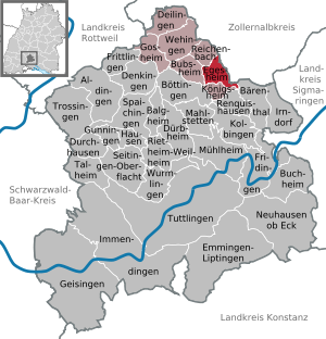
| Location of the municipality of Egesheim in the Tuttlingen district | ||
  |
||

Egesheim is a municipality in the district of Tuttlingen in Baden-Württemberg , Germany .
geography

Geographical location
Egesheim is located on the Großer Heuberg in the southwest of the Swabian Alb at an altitude of 690 m above sea level. NN on the southern border of the municipality in Bäratal and extends up to an altitude of 930 m above sea level. NN on a plateau in the eastern municipality.
The southern arm of the Bära , the so-called Lower Bära , flows through the community. Two thirds of the community area is covered by forest.
Neighboring communities
The community borders in the north on Reichenbach am Heuberg , in the east on Nusplingen in Zollernalbkreis , in the southeast on Bärenthal , in the south on Königsheim and in the west on Bubsheim .
Community structure
The village of Egesheim and the hamlet of Bärental (Hammer) belong to the municipality of Egesheim. The abandoned Granegg Castle (also Michelstein) and the abandoned Aussiedlerhof Mauchenhof are located in the municipality .
history
The municipality of Egesheim is one of the oldest municipalities in the region; it was mentioned as early as 770 in a deed of donation from the St. Gallen monastery . Various ecclesiastical and secular rulers owned the place. In 1381 the village came to Front Austria and stayed there until it became part of Württemberg in 1805 . In the Kingdom of Württemberg it was assigned to the Oberamt Spaichingen . During the regional reform in 1938, the place became part of the Tuttlingen district .
politics
Administrative association
The community is a member of the Heuberg community administration association based in Wehingen .
Municipal council
After the 2019 election, the municipal council has 8 members.
mayor
Schultheißen (until 1930) or mayor were:
- 1832–1869: Leonhard Reiser (1801–1875), father of Wilhelm von Reiser
- 1869–1879: Josef Sauter (1842–1900), farmer
- 1879–1907: Johann Baptist Blikle (1842–1913), carpenter
- 1908–1931: Jakob Keller (1868–1950), bookbinder
- 1931–1945: Franz Josef Sauter (1894–1967), master carpenter
- 1946–1952: Josef Paul (1896–1983), Wagner
- 1952–1970: Gallus Stier (1914–1990), farmer and sawmaker
- 1970–1982: Eugen Weber (1915–1987), previously Mayor of Gosheim 1949–1967
- 1982–2018: Josef Bär (* 1952, CDU), graduate in administration (FH), also mayor of Wehingen 1981–2016 and Reichenbach am Heuberg since 1988
- since 2018: Hans Marquart (* 1959, independent), graduate in business administration, 2002–2018 economic promoter of the city of Hechingen
coat of arms
|
|
Blazon : "In red a silver (white) harrow placed obliquely to the left, a six-pointed golden (yellow) star at the top right." |
| Justification of the coat of arms: The coat of arms awarded by the Ministry of the Interior on January 10, 1958 is derived from a seal from 1747, which showed the harrow as a talking image. It is a symbol of agriculture, which shaped the place for centuries. The colors silver and red were chosen to commemorate the former affiliation to the Grafschaft Hohenberg , whose coat of arms was a shield divided by silver and red. To distinguish it from other municipal coats of arms with a harrow, the star was added as a symbol. It can also be interpreted as a symbol for Maria , the church patroness in Egesheim. |
Banner and flag
 |
Banner: "The banner is white and red striped lengthways with the coat of arms above the middle." |
 |
Hoisted flag: "The flag is striped white and red with the coat of arms in the middle." |
Culture and sights
The municipality is affiliated with the "Donaubergland" tourist association.
Natural monuments
.jpg)
- Heidentor , an early Celtic cult site, on which a fortified hilltop settlement probably existed during the older Bronze Age (approx. 1500-1300 BC) and the more recent Urnfield Age (approx. 10th-9th centuries BC). The natural gate-like rock formation just below the northern edge of the plateau, which gives the “Heidentor” its name, is particularly impressive. The Heidentor is located northwest of Egesheim on the ridge of the Oberburg and is a popular hiking destination.
- The natural monument Beilsteinhöhle near Egesheim was an important Paleolithic (10,000 BC) habitat in the area of the Großer Heuberg . The name Beilsteinhöhle is derived from the stone ax heads found in the cave. Findings of stone, bone and ceramic implements made it possible for Stone Age people to use them until 2000 BC. Be proven.
- Burgruine Granegg also called Graneck or Michelstein , is the ruin of a rock castle on the castle rock 921 m above sea level. NN in Egesheim.
Economy and Infrastructure
According to the original plan, the Heubergbahn was to be built to Nusplingen and thus also to Egesheim. The railway was then only built as far as Reichenbach am Heuberg , almost three kilometers away , and shut down in 1966.
A poor, agricultural community became an industrial and workers' residential community. Agriculture is now only practiced as a sideline . Egesheim has a balanced commuter balance , which means that the same number of workers come to work from outside the community as Egesheimer earn their living outside the community. Egesheim has around 290 jobs.
Personalities
Sons and daughters of the church
- Wilhelm von Reiser (1835–1898), Bishop of Rottenburg, donated a nurses' station and a kindergarten for Egesheim
literature
- Egesheimer Heimatbuch. A Heuberg community in the past and present , 1998, ISBN 3-89570-449-0
Individual evidence
- ↑ State Statistical Office Baden-Württemberg - Population by nationality and gender on December 31, 2018 (CSV file) ( help on this ).
- ^ The state of Baden-Württemberg. Official description by district and municipality. Volume VI: Freiburg region Kohlhammer, Stuttgart 1982, ISBN 3-17-007174-2 , pp. 633–634.
- ↑ http://www.egesheim.de/index.php?id=100
- ↑ Egesheimer Heimatbuch, pp. 121–125; there are gaps in further mayors since 1451
- ↑ Hans Marquart is running in Egesheim , swp.de, April 3, 2018
- ↑ http://www.egesheim.de/index.php?id=75
- ↑ http://www.egesheim.de/index.php?id=74
Web links

Aldingen | Balgheim | Bärenthal | Böttingen | Bubsheim | Buchheim | Deilingen | Denkingen | Dürbheim | Durchhausen | Egesheim | Emmingen-Liptingen | Fridingen an der Donau | Frittlingen | Geisingen | Gosheim | Gunningen | Hausen ob Verena | Immendingen | Irndorf | Kolbingen | Koenigsheim | Mahlstetten | Mühlheim an der Donau | Neuhausen ob Eck | Reichenbach am Heuberg | Renquishausen | Rietheim-Weilheim | Seitingen surface | Spaichingen | Talheim | Trossingen | Tuttlingen | Wehingen | Wormlings