Binna
| Binna | ||
|
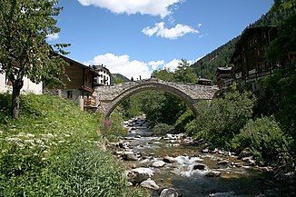
Bridge over the Binna near Binn |
||
| Data | ||
| Water code | CH : 106 | |
| location | Canton of Valais , Switzerland | |
| River system | Rhone | |
| Drain over | Rhone → Mediterranean | |
| source | at the Ofenhorn 46 ° 23 ′ 12 ″ N , 8 ° 17 ′ 55 ″ E |
|
| Source height | approx. 2530 m above sea level M. | |
| muzzle | near Grengiols in the Rhone coordinates: 46 ° 22 ′ 34 " N , 8 ° 6 ′ 7" E ; CH1903: 651044 / 136292 46 ° 22 '34 " N , 8 ° 6' 7" O |
|
| Mouth height | 867 m above sea level M. | |
| Height difference | approx. 1663 m | |
| Bottom slope | approx. 88 ‰ | |
| length | 18.9 km | |
| Catchment area | 116.66 km² | |
| Discharge at the mouth of the A Eo : 116.66 km² |
MQ Mq |
3.57 m³ / s 30.6 l / (s km²) |
The Binna is a 19 kilometer long left tributary of the Rhone in the canton of Valais . The river rises at the foot of the Ofenhorn at about 2530 m above sea level. M. near the Italian border. It then flows through the Binntal and finally flows into the Rhone at Grengiols . The Binna has a catchment area of 117 km². The largest tributary of the Binna is the Lengtalwasser . Further tributaries are the Wissenbach and the Feldbach , as well as the Mässerbach south-east of Fäld from the left .
Web links
Commons : Binna - collection of images, videos and audio files
- Binna on the ETHorama platform
- List of tributaries of the Rhone
Individual evidence
- ↑ a b c Geoserver of the Swiss Federal Administration ( information )
- ↑ a b Topographical catchment areas of Swiss waters: sub-catchment areas 2 km². Retrieved August 20, 2017 .
