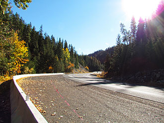
Blewett Pass
| Blewett Pass | |||
|---|---|---|---|
|
|
|||
| Pass height | 1257 m | ||
| Washington | Chelan County / Kittitas County | ||
| expansion | US Highway 97 | ||
| Mountains | Wenatchee Mountains ( Cascade Range ) | ||
| Map (Washington) | |||
|
|
|||
| Coordinates | 47 ° 20 '7 " N , 120 ° 34' 44" W | ||
The Blewett Pass (1,257 m high ) is a mountain pass in the Wenatchee Mountains (an eastward extension of the Cascade Range ) in the US state of Washington , which is crossed by US Highway 97 (US 97). Named after Edward Blewett, an 1880s Seattle mining entrepreneur, it is located on the historic Yellowstone Trail, the first transcontinental auto road.
Unlike many well-known passes on the main ridge of the Cascades, Blewett Pass is on the watershed between the Wenatchee River to the north and the Yakima River to the south. The highway over the pass connects Interstate 90 (I-90) between Seattle and Ellensburg with US Highway 2 between Monroe and Wenatchee . The Seattle to Wenatchee route over Snoqualmie Pass and Blewett Pass is a decent alternative to the route further north over Stevens Pass .
The pass known today as Blewett Pass was formerly called Swauk Pass . It should not be confused with the Old Blewett Pass , which is about 8 km west of today's pass at a lower altitude (1,239 m). The old pass roads are Forest Road 9715 and Forest Road 7320. They will be closed in winter so that a seasonal recreation can take place. Check with the Forest Service in Wenatchee National Forest about the reopening in the warmer months before using the roads.
Individual evidence
- ↑ Blewett Pass ( English ) In: Geographic Names Information System . United States Geological Survey . Retrieved January 8, 2013.
- ↑ Harry M. Majors: Exploring Washington . Van Winkle Publishing Co, 1975, ISBN 978-0-918664-00-6 , p. 96.
- ^ Washington Mile-by-Mile . The Yellowstone Trail Association. Archived from the original on July 25, 2013. Info: The archive link was inserted automatically and has not yet been checked. Please check the original and archive link according to the instructions and then remove this notice. Retrieved January 8, 2013.
- ^ Liberty, Washington , USGS 7.5 minute topographic map via Topoquest . USGS . Retrieved December 10, 2013.

