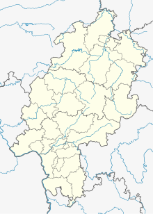
Bodenhausen (Waldeck)
Coordinates: 51 ° 12 ′ 30 ″ N , 9 ° 4 ′ 30 ″ E
Bodenhausen was a farm that was first mentioned in a document in 1487 in what is now the area around the core town of Waldeck in the northern Hessian district of Waldeck-Frankenberg .
Geographical location
The farm, owned by the Counts of Waldeck , was located at an altitude of 296 m , around 1.5 km east-northeast of the count's residence Schloss Waldeck and around 250 m east of the current building boundary of the city of Waldeck - under the high-voltage line there . Today the site lies in a strip of forest on the western slope of the valley of the networks that flow here from the north of the Eder in the south . The Ederseebahn cycle path , which was laid out from 2008 to 2012 on the route of the disused central section of the Ederseebahn ( Bad Wildungen - Korbach ), runs about 50 m to the east in the Bachtal , and another 50 m to the east runs parallel to the federal highway 485 . The Schadehausweg from Waldeck to the B 485 leads about 80 m south of the desert.
history
The farm was mentioned in 1487 when the county of Waldeck was divided: the farm "zu Bodenhausenn" was supposed to be shared between Count Philipp II. Von Waldeck-Eisenberg and Count Heinrich VIII. Von Waldeck-Wildungen, but Heinrich let his cousin use it. The place is then mentioned as "Boddenhausen" again in 1537 and finally in 1738, when the Lords of Geismar held two acres there as a Waldeck fiefdom , for the last time. The count's estate had long since been given up.
literature
- Heinrich Höhle: The submerged localities or Die Wüstungen in Waldeck , Bing, Korbach, 1931, p. 243, No. 5.
- C. Alhard von Drach (ed.), Gottfried Ganßauge (edit.): The architectural and art monuments in the government district of Cassel, new part 4: Kreis der Eder , Elwert, Marburg, 1939, p. 330.
Web links
- Bodenhausen, Waldeck-Frankenberg district. Historical local dictionary for Hessen. In: Landesgeschichtliches Informationssystem Hessen (LAGIS).
