Boudnib
| Boudnib بودنيب ⴱⵓⴷⵏⵉⴱ |
||||
|---|---|---|---|---|
|
||||
| Basic data | ||||
| State : |
|
|||
| Region : | Drâa-Tafilalet | |||
| Province : | Errachidia | |||
| Coordinates | 31 ° 57 ′ N , 3 ° 36 ′ W | |||
| Residents : | 11,373 (2014) | |||
| Area : | 6.74 km² | |||
| Population density : | 1,687 inhabitants per km² | |||
| Height : | 950 m | |||
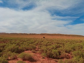
| Landscape near Boudnib | ||||
Boudnib or Boudenib ( Central Atlas Tamazight ⴱⵓⴷⵏⵉⴱ Budnib ; Arabic بودنيب) is a small town with about 12,000 inhabitants in the province of Errachidia in the Drâa-Tafilalet region in southern Morocco .
Location and climate
Boudnib is located on the Oued Guir , which has its source in the High Atlas but is mostly dry, in the rocky desert ( hammada ) landscape of southern Morocco at an altitude of approx. 950 m . The city of Errachidia is just 88 km (driving distance) to the west; the oasis town of Figuig about 230 km east. The climate is hot and dry; Rain (approx. 120 mm / year) falls - if at all - over the whole year.
population
| year | 1994 | 2004 | 2014 |
| Residents | 8,294 | 9,867 | 11,373 |
The settling down of nomads on the one hand and the immigration of people from the villages of the barren south on the other hand lead to sustained population growth.
History and economy
Boudnib was a resting place for nomads with date palms before the French stationed a garrison here around 1920. The small town lives on the one hand from the military that is still stationed in the area, on the other hand from the buses and trucks stopping here.
Attractions
Boudnib is a rest, repair and military station on national road 10 and apart from a city gate built by the French has no historically or culturally significant sights. The ruins of Borj Sud rise on a hill in the south of the city . About 14 km northwest of Tazouguert is the several kilometers long cave system of the Kef Aziza ( 32 ° 1 ′ 46 ″ N , 3 ° 47 ′ 17 ″ W ).


