
Breitenstein (Swabian Alb)
| Breitenstein | ||
|---|---|---|
.jpg) The Breitenstein from the west (Teck Castle) |
||
| height | 811.2 m above sea level NHN | |
| location | At Ochsenwang | |
| Mountains | Swabian Alb | |
| Coordinates | 48 ° 34 '59 " N , 9 ° 30' 5" E | |
|
||
| rock | White Jura | |

The Breitenstein is 811.2 m above sea level. NHN high rock plateau in Baden-Württemberg . It is located near the village of Ochsenwang on the district road 1220 in the district of the municipality of Bissingen an der Teck . The rock outcrop consists of white Jura stone and is located on the northern edge of the Swabian Alb directly on the Alb eaves .
From the plateau of the Breitenstein, which is around 200 meters wide, there is a wide view of the area around 400 meters below, north of the Swabian Alb , which is not obstructed by vegetation - in the north-west to Stuttgart - which is why it is a popular excursion destination almost all maps of the area are recorded.
There is a bronze plaque on the Breitenstein plateau, which shows the location and distance of the places visible from there.
The Breitenstein is designated both as a protected geotope and under the name of Felspartie des Breitenstein as well as an extensive natural monument .
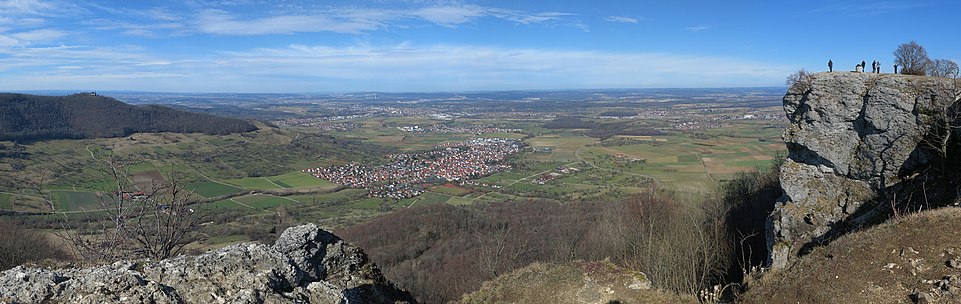
Panoramic view from the Breitenstein. In the center of the picture Bissingen an der Teck
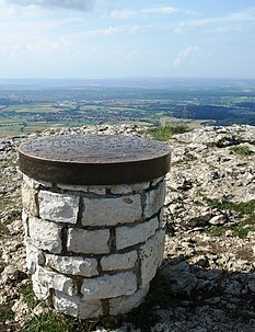
The bronze plaque with the location and distance of the places visible from the Breitenstein

Breitenstein from the northeast


Web links
- Profile of the extensive natural monument in the LUBW's list of protected areas
- Geotope profile (PDF, 370 kByte) on: Map server of the State Office for Geology, Raw Materials and Mining (LGRB) ( information )