Brookville, Indiana
| Brookville | ||
|---|---|---|
|
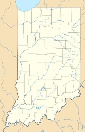
Location in Indiana
|
||
| Basic data | ||
| Foundation : | 1804 | |
| State : | United States | |
| State : | Indiana | |
| County : | Franklin County | |
| Coordinates : | 39 ° 25 ′ N , 85 ° 1 ′ W | |
| Residents : | 2,575 (as of 2014) | |
| Population density : | 645.4 inhabitants per km 2 | |
| Area : | 3.99 km 2 (approx. 2 mi 2 ) | |
| Height : | 203 m | |
| FIPS : | 18-08182 | |
| GNIS ID : | 431586 | |
Brookville is a town in Brookville Township in Franklin County in the US state of Indiana . Franklin County's administrative headquarters are in Brookville.
geography
The area of Brookville is 3.99 km². The city is at the fork of the Whitewater River . To the west of the left fork is County Park. Brookville borders Brookville Lake to the north . US Highway 52 runs through Brookville and can also be used to reach the northwestern capital of Indiana, Indianapolis , 105 kilometers away .
history
Although people began to settle in what is now Brookville's area earlier, the area wasn't officially discovered by Amos Butler until 1804. In 1808 the area was surveyed by Thomas Manwarring. The town was named after the mother of an owner, whose maiden name was Brooks. It is also possible that the town got its name because of the many streams that flow from the hills and so feed the Whitewater River.
According to a Times report in 1817, Brookville had more than 80 households, a variety of smaller businesses, seven shops, a market house, courthouse, and prison.
Brookville was a military base in 1820. In addition, the development of the city was advanced between 1823 and 1825 when Brookville was the location of a US land office where land could be purchased. When the office moved to Indianapolis in 1825, Brooksville experienced a period of economic downturn. That changed with the opening of the Whitewater Canal in 1839. The canal used hydropower to produce goods and transport. This resulted in better economic performance.
The canal was flooded several times and some sections were destroyed. This also affected the associated economic operation. Meanwhile, Brookville waited for the railroad to be completed.
As the community grew, the demand for wood and trees for the paper mill along the canal grew. There was extreme deforestation of the surrounding forests.
In 1975 the Brookville Dam was completed by the US Army Corps of Engineers .
Demographics
In 2014 there were 2,575 people in Brookville. This means that the city has recorded a population decline of 2.9 percent since 2000. 41.6 percent of the population were male, 58.4 percent female. The mean age was 40.5 years.
Personalities
sons and daughters of the town
- Lew Wallace (1827–1905), lawyer, general, politician and writer
- John St. John (1833–1916), politician and governor of the state of Kansas from 1879 to 1883
- Roswell Winans (1887-1968), General
- Hanna Hilton (* 1984), porn actress and model
Personalities related to the city
- James B. Ray (1794–1848), politician and governor of the state of Indiana from 1825 to 1831
- David Wallace (1799-1859), politician and governor of the state of Indiana from 1837 to 1840
Individual evidence
- ↑ Brookville, IN - Brookville, Indiana Map & Directions - MapQuest. In: www.mapquest.com. Retrieved August 12, 2016 .
- ↑ Brookville. In: www.franklincountyhistoricalsociety.com. Retrieved August 12, 2016 .
- ↑ Brookville, Indiana (IN 47012) profiles: population, maps, real estate, averages, homes, statistics, relocation, travel, jobs, hospitals, schools, crime, moving, houses, news, sex offenders. In: www.city-data.com. Retrieved August 12, 2016 .
- ^ Roswell Winans , findagrave.com
