Allenbüttel
|
Allenbüttel
Calberlah Parish
Coordinates: 52 ° 23 ′ 37 ″ N , 10 ° 37 ′ 49 ″ E
|
|
|---|---|
| Height : | 72 m |
| Area : | 3.33 km² |
| Residents : | 210 (Aug 2016) |
| Population density : | 63 inhabitants / km² |
| Incorporation : | March 1, 1974 |
| Postal code : | 38547 |
| Area code : | 05301 |
|
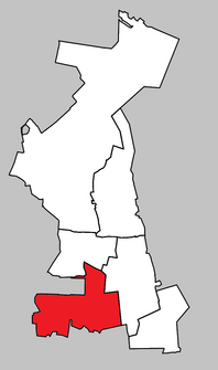
Location of Allenbüttel in Calberlah
|
|
Allenbüttel is a district of the municipality of Calberlah in Lower Saxony . The municipality of Calberlah, in turn, is a member municipality of the joint municipality of Isenbüttel in the Gifhorn district .
Geographical location
The village is centrally located in the triangle of Gifhorn , Wolfsburg and Braunschweig . The Elm is 30 km to the southeast .
history
In the course of the Prussian municipal area reform of 1929, the previously independent municipality of Brunsbüttel was incorporated into Allenbüttel.
On March 1, 1974, Allenbüttel was incorporated into the municipality of Calberlah.
traffic
The Hanover-Berlin railway line runs 4 km to the north. Federal Motorway 2 is 14 km south and Federal Motorway 39 is 10 km east . The Elbe Lateral Canal branches off from the Mittelland Canal 2 km to the northwest . The state road L321 runs through Allenbüttel. a. Wolfsburg connects with the B4.
Associations and associations
- Volunteer firefighter
- Association for the care of the village community
Attractions
The village community center (DGH) is located in the center of the village. The village school was located here until 1963. After the school closed, it was partially used as a residential building. A few years ago it was renovated from the ground up for the most part by the villagers themselves. It can be rented for various festivities. The garage and training rooms of the volunteer fire brigade are located in an extension behind the DGH. There is a memorial right in front of the DGH. It consists of large boulders with an iron cross. The year 1813 , the initials "FW" and oak leaves can be seen on the cross .
confusion
In the municipality of Calberlah there is also the district of Allerbüttel . This is located around 3 km to the north and has the same postcode, so that people who are unfamiliar with the area can be confused.
Individual evidence
- ^ Federal Statistical Office (ed.): Historical municipality directory for the Federal Republic of Germany. Name, border and key number changes in municipalities, counties and administrative districts from May 27, 1970 to December 31, 1982 . W. Kohlhammer GmbH, Stuttgart and Mainz 1983, ISBN 3-17-003263-1 , p. 226 .
