
Möstling castle ruins
| Möstling castle ruins | ||
|---|---|---|
 Möstling castle ruins |
||
| Creation time : | unknown
(first documentary mention) |
|
| Castle type : | Höhenburg, location | |
| Conservation status: | Ruin, only remnants | |
| Place: | Matzelsdorf, municipality of Neumarkt in the Mühlkreis | |
| Geographical location | 48 ° 24 '56.9 " N , 14 ° 28' 31" E | |
|
||

The Möstling castle ruins are located in the Matzelsdorf district of the Neumarkt im Mühlkreis district in the Freistadt district .
history
The ruins of the Höhenburg lie on a ridge around which the Kleine Gusen loops. The name of the castle is lost. It was an elongated complex facing northwest.
Little is known about the castle. Due to its size, it cannot have been the seat of a member of the lower nobility (honorable servant). It was suspected that it might have belonged to Otto von Chornspach , who was documented several times and who owned many properties in this area. However, based on current research, this ascription is incorrect. In 1499 the ruin is mentioned in a document as "pueckhstall" , so it was already in ruins at that time. In the arable land of the Freistadt rule, there are two field names that refer to the castle: Purgkhstall (1565) and Purchstall (1590). The castle probably served as a place of refuge during the Bohemian invasions in the 14th century and during the Hussite Wars in the 15th century. It is believed that it was destroyed by the Hussites and not rebuilt.
Möstling today
The remains of the castle extend over 60 meters in an east-west direction on two terraces. The castle site was precisely measured. The outer walls are up to 2.5 meters, the inner height is up to 1.70 meters. On the southeast side there is a cast wall, the outer stones of which were once hewn. These blocks broke out in many places and were dragged off. A window opening can be seen on the southwest side, but its lintel has broken out. Within the circular wall enclosed area is a rectangular overgrown mounds of rubble, possibly the in the Palas has confessed. A square main tower is assumed, of which foundation walls are still left. A double trench section and the path leading to the castle can be seen, which was laid out so that the side uncovered by the shield faced the wall.
According to oral tradition, the Burmerhof in Matzelsdorf is said to have been the Meierhof to the castle. In the basement of the Burmerhaus there is an about 15 meter long, meanwhile collapsed corridor, which is said to have led to the castle.
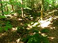
The masonry is a little hard to find; If you go north from house No. 26 of Möstling, you come across the Burgstall in the forest. The walls are mostly overgrown by trees and plants and difficult to see in the terrain.
Picture gallery

Möstling castle ruins

Möstling castle ruins
Möstling castle ruins


literature
- Norbert Grabherr : Castles and palaces in Upper Austria. A guide for castle hikers and friends of home. 3rd edition . Oberösterreichischer Landesverlag, Linz 1976, ISBN 3-85214-157-5 .
- Christian K. Steingruber : A critical consideration of the historical-topographical manual by Norbert Grabherr . Upper Austrian Provincial Archives , Linz.
Web links
- Möstling. In: Burgenkunde.at.
- Neumarkt in the Mühlkreis
- Burgstall Moestling on the Archaeological Information System for Upper Austria (AIS-OOE)
Individual evidence
- ↑ Marina Kaltenegger, Thomas Kühtreiber , Gerhard Reichhalter, Patrickschicht and Herwig Weigl: Burgen im Mostviertel. Freytag-Berndt and Artaria KG, Vienna 2007, ISBN 3-7079-1041-5 .
- ^ Möstling on Burgseite.com