Camaquã
| Camaquã | ||
|---|---|---|
|
Coordinates: 30 ° 51 ′ S , 51 ° 49 ′ W Camaquã on the map of Rio Grande do Sul
|
||
| Basic data | ||
| Country | Brazil | |
| State | Rio Grande do Sul | |
| City foundation | April 19, 1864 | |
| Residents | 62,759 (2010 census) | |
| City insignia | ||
| Detailed data | ||
| surface | 1,679.556 km 2 | |
| Population density | 37.2 inhabitants / km 2 | |
| height | 39 m | |
| Waters | Lagoa dos Patos | |
| Time zone | UTC −3 | |
| City Presidency | Ernesto Mollon ( PMDB ) | |
| Website | ||
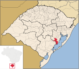
| Location of Camaquã in Rio Grande do Sul | ||
| Igreja Matriz | ||
Camaquã is a city in the state of Rio Grande do Sul in southern Brazil . It is located about 120 km southwest of Porto Alegre on the Lagoa dos Patos . Adjacent are the places São Jerônimo , Cerro Grande do Sul , São Lourenço do Sul , Arambaré , Sentinela do Sul , Dom Feliciano , Amaral Ferrador , Cristal and Chuvisca .
Individual evidence
- ↑ Population data from the 2010 IBGE census , 2010 (PDF, Portuguese; 51 kB), accessed on March 5, 2011


