Cannon City
| Cannon City | ||
|---|---|---|
|
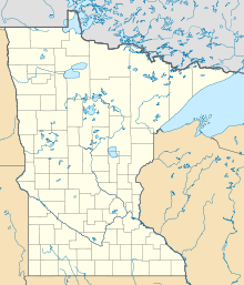
Location in Minnesota
|
||
| Basic data | ||
| State : | United States | |
| State : | Minnesota | |
| County : | Rice County | |
| Coordinates : | 44 ° 20 ′ N , 93 ° 13 ′ W | |
| Time zone : | Central ( UTC − 6 / −5 ) | |
| Residents : | 100 (as of 2010) | |
| Height : | 367 m | |
| Area code : | +1 507 | |
| FIPS : | 27-09694 | |
| GNIS ID : | 640869 | |
Cannon City is a settlement on community-free area ( " Unincorporated Community ") in Rice County of middle-southeast US -amerikanischen state of Minnesota . The place has around 100 inhabitants.
Cannon City is part of the CSA (Combined Statistical Area) Minneapolis-St. Paul-St. Cloud , the expanded Minneapolis-Saint Paul metropolitan area .
geography
Cannon City is just south of the Twin Cities east of the Cannon River , a right tributary of the Mississippi . The place is 44 ° 19'45 "north latitude and 93 ° 12'41" west longitude. Cannon City is located in the Cannon City Township .
Neighboring towns to Cannon City are Faribault (7 km southwest), Dundas (12.3 km north), Northfield (16.2 km north-northeast), Dennison (23 km northeast), Nerstrand (13.2 km east) and Kenyon (23 , 4 km southeast).
The center of Minneapolis is located 84.6 kilometers north; the center of Saint Paul , the capital of Minnesota, is 77.9 km northeast. Rochester , Minnesota's third largest city, is 90 km southeast.
traffic
The main street is Cannon City Boulevard, a street that comes from Faribault and leads north to Dundas. All other roads are subordinate, partly unpaved roads as well as inner-city connecting roads.
The Faribault Municipal Airport is a small airfield 10.7 km to the west. The nearest major airport is Minneapolis-Saint Paul International Airport, 79.1 km north .
Individual evidence
- ↑ Distance information according to Google Maps. Accessed on March 23, 2013
