Cape Hatteras
Coordinates: 35 ° 15 ′ 2 " N , 75 ° 31 ′ 43.7" W.

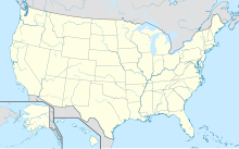
The Cape Hatteras ( German Kap Hatteras ) is a cape on the east coast of the United States .
location
The headland, which protrudes far into the Atlantic, is the furthest southeastern point in the USA in the state of North Carolina . The cape is located on Hatteras Island , which is part of the Outer Banks .
Weather
Two of the main Atlantic currents, the cold Labrador Current flowing in a southerly direction and the warm Gulf Stream moving north , meet at Cape Hatteras, which means that the waters in front of the headland are mostly rough and shallow sandbars arise. Due to its exposed location, the cape is often hit by hurricanes that approach the coast. The Hurricane Isabel of 2003 has particularly drawn the area affected. Isabel devastated the Outer Banks and disrupted North Carolina State Route 12 , which runs from Nags Head to the island.
The lighthouse
It was the dangers of the sea that led to the construction of the lighthouses, which are among the most prominent coastal structures in North Carolina. The first lighthouse was built on the cape in 1803 and replaced by the current tower in 1870. At 64 meters tall, it is the tallest lighthouse in the United States and the tallest brick lighthouse in the world. In March 1978, the lighthouse was listed as a Historic District on the National Register of Historic Places . In August 1998, the Cape Hatteras Light Station was granted the status of a National Historic Landmark . In 1999 it had to be relocated 884 meters into the interior of the island because the coastline had already moved dangerously close to the old location due to coastal erosion . In the same year he was added to the List of Historic Civil Engineering Landmarks by the American Society of Civil Engineers .
Special features of the animal world
Due to the different warm ocean currents, the location of Cape Hatteras, similar to Point Conception in California, forms a boundary for the habitat of different species of living beings, which have their northernmost or southernmost occurrence here. This is one of the reasons why the Cape Hatteras National Seashore was established. Cape Hatteras is the southernmost point of distribution of the northern diamond turtle , a species of turtle from the New World pond turtle family that specializes in brackish water .
Ship graveyard
The dangers at sea, such as strong currents, storms and shallows, have often led to navigation problems in the past. Many ships were lost off the coast in the centuries. These events gave the area before the Outer Banks the name "Cemetery of the Atlantic". More than 2,000 ships are said to have sunk here. Countless sailors lost their lives. The Graveyard Of The Atlantic Museum in Hatteras is full of exhibits dedicated to the eventful maritime history of this treacherous lake area. The US weather and ocean authority NOAA oversees the "Monitor National Marine Sanctuary", which contains numerous wrecks from the Second World War , but also from before. Most famous are the remains of the eponymous USS Monitor .
Climate table
| Cape Hatteras | ||||||||||||||||||||||||||||||||||||||||||||||||
|---|---|---|---|---|---|---|---|---|---|---|---|---|---|---|---|---|---|---|---|---|---|---|---|---|---|---|---|---|---|---|---|---|---|---|---|---|---|---|---|---|---|---|---|---|---|---|---|---|
| Climate diagram | ||||||||||||||||||||||||||||||||||||||||||||||||
| ||||||||||||||||||||||||||||||||||||||||||||||||
|
Average monthly temperatures and rainfall for Cape Hatteras
Source: wetterkontor.de
|
|||||||||||||||||||||||||||||||||||||||||||||||||||||||||||||||||||||||||||||||||||||||||||||||||||||||||||||||||||||||||||||||||||||||
Web links
- National Park Service: Cape Hatteras National Seashore (official site; English)
Individual evidence
- ^ Cape Hatteras Light Station on the National Register Information System. National Park Service , accessed February 3, 2020.
- ↑ Listing of National Historic Landmarks by State: North Carolina. National Park Service , accessed February 3, 2020.
- ^ Page about the ship cemetery .

