Catubig
| Municipality of Catubig | ||
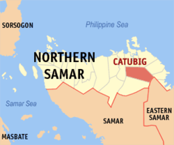
| Location of Catubig in the Northern Samar Province | ||
|---|---|---|

|
||
| Basic data | ||
| Region : | Eastern Visayas | |
| Province : | Northern Samar | |
| Barangays : | 47 | |
| District: | 2. District of Northern Samar | |
| PSGC : | 084806000 | |
| Income class : | unknown (1-6) | |
| Households : | 5015 May 1, 2000 census
|
|
| Population : | 33,025 August 1, 2015 census
|
|
| Coordinates : | 12 ° 25 ′ N , 125 ° 3 ′ E | |
| Postal code : | 6418 | |
| Mayor : | Ma. Cristina L. Vicenco | |
| Geographical location in the Philippines | ||
|
|
||
Catubig is a Filipino municipality in the Northern Samar Province . It has 33,025 inhabitants (August 1, 2015 census). The river Catubig has its source in the municipality and flows into the Philippine Sea .
Barangays
Catubig is politically divided into 47 barangays .
|
|
|
history
During the Philippine-American War , Catubig was the site of a battle between the Samarnons and the Americans, which lasted from April 15 to April 19 and which took place as a result of the siege of Catubig .
