Chalchihuites
| Chalchihuites | ||
|---|---|---|
|
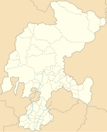
Coordinates: 23 ° 29 ′ N , 103 ° 53 ′ W Chalchihuites on the map of Zacatecas
|
||
| Basic data | ||
| Country | Mexico | |
| State | Zacatecas | |
| Municipio | Chalchihuites | |
| Residents | 3799 (2010) | |
| - in the metropolitan area | 10,565 | |
| Detailed data | ||
| surface | 2.88 km 2 | |
| Population density | 1,319 inhabitants / km 2 | |
| height | 2265 m | |
| Post Code | 99260 + 99270 | |
| Website | ||
| Chalchihuites - Church of San Pedro Apóstol | ||
Chalchihuites is a place with almost 4,000 inhabitants and the capital of a municipality (municipio) with a total of approx. 12,000 inhabitants in the Mexican state of Zacatecas . The site was recognized as a World Heritage Site by UNESCO in 2010 as part of the Camino Real de Tierra Adentro .
Location and climate
The place Chalchihuites is about 220 km (driving distance) northwest of the provincial capital Zacatecas near the border with the state of Durango at an average altitude of about 2265 m . The climate is mostly warm; Rain (approx. 580 mm / year) falls mainly in the summer half-year.
Population development
| year | 2000 | 2005 | 2010 |
| Residents | 3,999 | 3,689 | 3,799 |
The population has remained roughly stable since the last decades of the 20th century.
economy
Silver, copper, lead and zinc ores have been mined in the surrounding mines for centuries. But livestock breeding (cattle, sheep, goats, pigs) also plays an important role in the life of the community; In addition, the cultivation of grain (maize, wheat, barley) and the cultivation of fruit and vegetables (beans, chillies, tomatoes, prickly pears, peaches, pears, figs, walnuts) are important. Small traders, craftsmen and service providers of all kinds have settled in the city itself.
history
The name of the place is derived from the Chalchihuit Indians who once lived here, but at the time of the conquest (conquista) by the Spaniards, the areas in northern New Spain were only sparsely populated; Fixed houses, stone temples or even urban structures did not exist or no longer existed, because the Altavista cult site had been abandoned around 300 years before the arrival of the Spaniards. The place Chalchihuites was founded in 1556 by the captain Martín Perez; The settlement Real de las Mines del Valle de San Pedro de los Chalchihuites underwent a further development in 1591 by the instigation of the viceroy Luis de Velasco y Castilla to secure the "Silver Road" ( Camino Real de Tierra Adentro ) between Mexico City and the mines of the north sent new settlers.
Attractions
- The pre-Columbian ruins Altavista is only about 500 m south of today's town.
- The double-towered, but only single-nave church of San Pedro Apóstol was built in the 17th and 18th centuries. Century. It has a transept and a crossing dome with a window wreath resting on a drum . The classical main altar is designed like a two-storey tabernacle.
Web links
- Chalchihuites, history - photos + info (Spanish)

