Chavanette
| Chavanette | |||
|---|---|---|---|
|
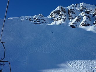
View of the Chavanette slope in Switzerland |
|||
| Compass direction | west | east | |
| Pass height | 2144 m above sea level M. | ||
| region | Department Haute-Savoie | Canton of Valais | |
| Watershed | On it | Vièze | |
| Valley locations | Morzine | Champéry | |
| expansion | Mountain path | ||
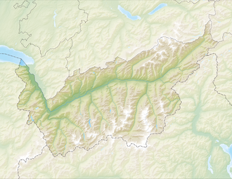
| Map (Valais) | |||
|
|
|||
| Coordinates , ( CH ) | 46 ° 10 '28 " N , 6 ° 48' 23" O ( 551173 / 113861 ) | ||
Chavanette is the name of a mountain pass ( Pas de Chavanette ) between Champéry ( Switzerland ) and Avoriaz / Morzine ( France ) and a steep ski slope on the east side of this pass.
Passport description
The Pas de Chavanette ( 2144 m above sea level ) is a foot crossing over the border chain of the Franco-Swiss pre-Alps. It connects the Planachaux – Les Pas alpine region (commune of Champéry in the Val d'Illiez valley ) in the east with the alpine region of Avoriaz (the commune of Morzine, famous today as a ski station ) in the west. The name comes from the Alp Chavanette, which is 300 meters below the pass on the west side.
In winter, the pass is one of the transition points between the French and Swiss parts of the cross-border ski area Portes du Soleil . It is served by two parallel ski lifts on the west side and a chairlift on the east side.
Description of the ski slope
The Chavanette (also called "Mur de Chavanette" or "Swiss Wall") is a mogul slope on the east side of the Pas de Chavanette in the Champéry / Portes du Soleil ski area . It is notorious for its difficulty (80% average slope in the upper part, because of the steepness cannot be groomed with snow groomers , it would also be too steep with winches. In some places the slope is over 100%). Less experienced skiers who use the crossover at Pas de Chavanette can take the chairlift down on the east side.
- Starting point: Pas de Chavanette ( 2144 m above sea level )
- Destination point: Les Pas ( 1820 m above sea level )
- Difference in altitude: 324 meters
- Length: 1000 meters

