Cherokee Lake (Holston River)
| Cherokee Lake Cherokee Dam |
|||||||
|---|---|---|---|---|---|---|---|
|
|||||||
|
|
|||||||
| Coordinates | 36 ° 12 '54 " N , 83 ° 26' 6" W | ||||||
| Data on the structure | |||||||
| Construction time: | 1940-1941 | ||||||
| Height of the barrier structure : | 53 m | ||||||
| Crown length: | 2 060 m | ||||||
| Power plant output: | 135.2 MW | ||||||
| Operator: | Tennessee Valley Authority (TVA) | ||||||
| Data on the reservoir | |||||||
| Altitude (at congestion destination ) | 330 m | ||||||
| Water surface | 1 165 km² | ||||||
| Storage space | 924 379 000 m³ | ||||||
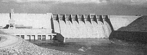
| Cherokee Dam (in the 1940s) | |||||||
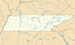
Cherokee Lake, also known as Cherokee Reservoir, is a reservoir in Tennessee .
It was created by the damming of the Holston River above the Cherokee Dam.
The dam has a water area of 1165 km² and a storage space of 924,379,000 m³. The water level of the reservoir usually fluctuates by 8.2 m over the year. The Cherokee Dam is operated by the Tennessee Valley Authority and is used for power generation and flood protection . The dam was built in record time. Construction began on August 1, 1940, and was completed on December 5, 1941.
There are publicly accessible banks at the reservoir, Panther Creek State Park, and other public parks. There is also a commercial landing stage, resorts and a state wildlife management area along the shoreline. All of this allows the reservoir to be used for various leisure activities.
In order to ensure sufficiently high concentrations of dissolved oxygen in the river below the reservoir, which are vital for the river fauna and flora, oxygen is pressed into the lower water layers of the reservoir.
Web links
- Fishing Map of Cherokee Reservoir (PDF; 780 kB)
- Cherokee Lake in the United States Geological Survey's Geographic Names Information System
Individual evidence
- ↑ a b c d e Cherokee Reservoir factsheet, Tennessee Valley Authority
- ^ Water Quality Improvements at Tributary Dams: Cherokee Dam, Tennessee Valley Authority


