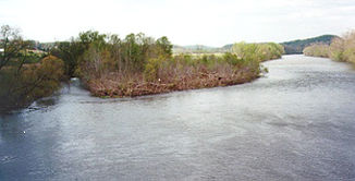
Holston River
| Holston River | ||
|
North Fork Holston River at Weber City |
||
| Data | ||
| Water code | US : 1303469 | |
| location | Tennessee (USA) | |
| River system | Mississippi River | |
| Drain over | Tennessee River → Ohio River → Mississippi River → Gulf of Mexico | |
| confluence | of North Fork Holston River and South Fork Holston River 36 ° 32 ′ 51 " N , 82 ° 36 ′ 45" W |
|
| Source height | 354 m | |
| Union | with French Broad River to the Tennessee River Coordinates: 35 ° 57 ′ 33 " N , 83 ° 51 ′ 1" W 35 ° 57 ′ 33 " N , 83 ° 51 ′ 1" W |
|
| Mouth height | 248 m | |
| Height difference | 106 m | |
| Bottom slope | 0.48 ‰ | |
| length | 219 km | |
| Catchment area | 9700 km² | |
| Drain |
MQ |
137.3 m³ / s |
| Reservoirs flowed through | Cherokee Lake | |
|
Holston River catchment area |
||
The Holston River is a major river in eastern Tennessee, USA.
The two headwaters of the Holston River ( North Fork Holston River and South Fork Holston River ) have their origin in Southwest Virginia. They unite at Kingsport to form the main river.
The North Fork Holston River flows 150 miles southwest of Sharon Springs in Bland County . The shorter South Fork, but due to the three times larger catchment area, rises near Sugar Grove in Wythe County . From there it flows 180 km in a southwesterly direction before meeting the North Fork near Kingsport. The actual Holston River then flows another 219 km north of Bays Mountain in a south-westerly direction, to finally merge with the French Broad River to form the Tennessee River east of downtown Knoxville .
In the valley of the Holston River there are a number of power plants for electricity generation - hydroelectric power plants and coal-fired plants . The higher-lying power plants are privately owned, while the lower-lying power plants are operated by the Tennessee Valley Authority . On the Holston River, the Cherokee Dam with the associated Cherokee Lake should be mentioned.
The river was named after Stephen Holstein. In 1746 he built a wooden hut on the upper reaches of the river. The mountain Holston Mountain in turn was named after the river.
The confluence of the Holston River and French Broad Rivers at mile post 652 in Knoxville is now considered to be the starting point of the Tennessee River. Before 1933, the Holston River officially ran a further 82 km downstream to Lenoir City and the mouth of the Little Tennessee River . At that time this place was considered to be the starting point of the Tennessee River.
All three headwaters of the Holston River and the river proper are easily accessible and offer recreational opportunities such as canoeing, fishing or fly fishing. However, the North Fork Holston River below Saltville is contaminated with heavy metals and fish from the water should not be consumed.
Web links
Individual evidence
- ^ North Fork Holston River in the United States Geological Survey's Geographic Names Information System
- ↑ a b c Holston River in the Geographic Names Information System of the United States Geological Survey
- ↑ George R. Stewart [1945]: Names on the Land: A Historical Account of Place-Naming in the United States , Sentry edition (3rd). Edition, Houghton Mifflin , 1967.
- ^ Description on the Virginia Department of Game and Inland Fisheries website. Retrieved May 24, 2020 .

