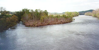
North Fork Holston River
| North Fork Holston River | ||
|
North Fork Holston River near Weber City |
||
| Data | ||
| Water code | US : 1306839 | |
| location | Virginia , Tennessee (USA) | |
| River system | Mississippi River | |
| Drain over | Holston River → Tennessee River → Ohio River → Mississippi River → Gulf of Mexico | |
| source | in Bland County ( Virginia ) 37 ° 3 '51 " N , 81 ° 16' 15" W |
|
| Source height | 883 m | |
| Union | with South Fork Holston River to Holston River Coordinates: 36 ° 32 ′ 52 " N , 82 ° 36 ′ 45" W 36 ° 32 ′ 52 " N , 82 ° 36 ′ 45" W |
|
| Mouth height | 354 m | |
| Height difference | 529 m | |
| Bottom slope | 2.2 ‰ | |
| length | 243 km | |
| Catchment area | 1889 km² | |
| Right tributaries | Moccasin Creek | |
The North Fork Holston River is a river in the eastern United States . It is the northern headwaters of the Holston River , which it forms from Kingsport in Tennessee together with the South Fork Holston River .
The river has its source in Bland County in the US state of Virginia . The source is near the Tennessee Valley Divide , the watershed between the Tennessee River and the New River, which runs north . The North Fork Holston River flows mainly southwest through Virginia, first in a valley between Walker and Brushy Mountain , two elongated Appalachian mountain ranges. The middle reaches of the river follows the south side of Clinch Mountain , before turning south just before the state line and joining the South Fork Holston River after a few kilometers in Tennessee.
Unlike the South Fork, there are no large reservoirs on the North Fork Holston River. The river is 243 km long and has a drainage area of 1889 square kilometers.
