Chilkat River
| Chilkat River | ||
|
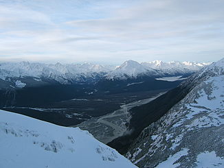
View of the Chilkat River from the Takshanuk Mountains |
||
| Data | ||
| Water code | US : 1421032 | |
| location |
Alaska ( USA ), British Columbia ( Canada ) |
|
| River system | Chilkat River | |
| origin |
Chilkat Glacier 59 ° 44 ′ 30 ″ N , 135 ° 47 ′ 46 ″ W |
|
| Source height | approx. 200 m | |
| muzzle | in the Chilkat Inlet ( Lynn Canal ) Coordinates: 59 ° 15 '43 " N , 135 ° 36' 37" W 59 ° 15 '43 " N , 135 ° 36' 37" W. |
|
| Mouth height | 0 m | |
| Height difference | approx. 200 m | |
| Bottom slope | approx. 2.5 ‰ | |
| length | approx. 80 km | |
| Right tributaries | Tahini River, Klehini River , Tsirku River , Kelsall River , Takhin River, Kicking Horse River | |
| Communities | Haines | |
The Chilkat River is an approximately 80 km long tributary of the Lynn Canal in the Alaska Panhandle and in neighboring British Columbia .
The origin of the Chilkat River is formed by the glacial edge lake of the Chilkat Glacier in the Chilkoot Ranges in Canada. The Chilkat River initially flows in a predominantly southwestern direction. After 8 km he crosses the border into Alaska. Below the confluence of the Kelsall River , it turns south-southeast. From Wells , where the Tsirku River flows into the Chilkat, the Haines Highway runs parallel to the river and accompanies it to its elongated estuary at the upper end of the Chilkat Inlet , part of the Lynn Canal.
At the lower reaches of the Chilkat River is the Alaska Chilkat Bald Eagle Preserve with the largest bald eagle population on earth.
The river is named after the Chilkat Indians, a group of the Tlingit .
literature
- Geographic Society, Alaska: Chilkat River Valley (Alaska Geographic, Vol. 11, Number 3, 1984) . Alaska Northwest Books, ISBN 978-0-88240-203-1 .
Web links
- Chilkat River . In: BC Geographical Names (English)
- Alaska Chilkat Bald Eagle Preserve (English)
