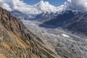
Chitina glacier
| Chitina glacier | ||
|---|---|---|
|
Chitina Glacier (July 2015) |
||
| location | Alaska (USA), Yukon (Canada) | |
| Mountains | Elias chain | |
| Type | Valley glacier | |
| length | 77 km | |
| Exposure | west | |
| Altitude range | 3000 m - 640 m | |
| width | ⌀ 1.8 km; Max. 2.6 km | |
| Coordinates | 60 ° 59 ′ N , 141 ° 23 ′ W | |
|
|
||
| drainage | Chitina River → Copper River | |
The Chitina Glacier is a 77 km long valley glacier in the Elias chain in Yukon ( Canada ) and Alaska ( USA ).
The Chitina Glacier's nutrient zone is located between the Mount Slaggard and Mount Steele mountains in Canada's Yukon Territory. From there it flows west to Alaska. The ridge of Mount Lucania rises south of the glacier. The most important tributary glacier is the Anderson Glacier , which joins on the right 20 km above the lower end of the glacier when coming from the north. The Chitina Glacier ends on the north bank of the Chitina River at an altitude of about 640 m . Together with the Logan Glacier , which also runs further south in a westerly direction, the Chitina Glacier forms the source of the river. The mean width of the Chitina Glacier is 1.8 km above the confluence of the Anderson Glacier and 2.6 km below the confluence. The catchment area of the glacier covers around 1650 km².

