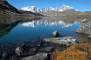
Chomoyummo
| Chomoyummo | ||
|---|---|---|
|
View of Chomoyummo (on the right) from the east |
||
| height | 6829 m | |
| location |
North Sikkim ( India ), Tibet ( PR China ) |
|
| Mountains | Chorten Nyima Group ( Himalayas ) | |
| Dominance | 12.01 km → Kangchengyao | |
| Notch height | 1559 m ↓ Naku La ( 5270 m ) | |
| Coordinates | 28 ° 2 '1 " N , 88 ° 32' 42" E | |
|
|
||
| First ascent | 1911 by Alexander Mitchell Kellas and Sherpas | |
The Chomoyummo (also Chomo Yummo or Chomiomo ) is a mountain in the Himalayas on the border between Sikkim in India and Tibet in China .
The Chomoyummo has a height of 6829 m . It is located in the eastern main Himalayan ridge in the north of Sikkim. The northern flank of the Chomoyummo lies in Tibet and is drained to the Yairu Zangbo , a left tributary of the Bum Chu (upper reaches of the Arun ). On the southeast flank of the Chomoyummo runs the upper reaches of the Lachen Chu , the right source river of the Tista . On the opposite side of the valley rises the 6920 m high Kangchengyao, 12 km east-southeast . A mountain ridge branches off at Chomyummo from the main ridge in a southerly direction. This separates the upper reaches of the Lachen Chu from the Zemu Chu .
Ascent history
The Chomoyummo was first climbed in 1911 by the Scottish alpinist Alexander Mitchell Kellas , accompanied by Sherpas.
Web links
- Chomo Yummo, China / India on Peakbagger.com (English)

