Cobbs Creek (Darby Creek)
| Cobbs Creek | ||
|
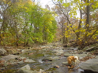
Cobbs Creek at Nitre Hall |
||
| Data | ||
| Water code | US : 1172099 | |
| location | Pennsylvania , United States | |
| River system | Delaware River | |
| Drain over | Darby Creek → Delaware River → Atlantic Ocean | |
| source | at Garrett Hill , Delaware County 40 ° 0 ′ 42 " N , 75 ° 19 ′ 0" W |
|
| muzzle | at Sharon Hill in Darby Creek Coordinates: 39 ° 54 ′ 21 ″ N , 75 ° 15 ′ 17 ″ W 39 ° 54 ′ 21 ″ N , 75 ° 15 ′ 17 ″ W |
|
| Mouth height |
5 m
|
|
| length | 18 km | |
| Catchment area | 38 km² | |
| Left tributaries | Naylors Run , Indian Creek | |
| Right tributaries | Thomas Run Creek, Paschall Creek, Mingo Creek | |
| Big cities | Philadelphia | |
| Medium-sized cities | Upper Darby Township , Darby , Millbourne | |
The Cobbs Creek is a small tributary of Darby Creek in the US state of Pennsylvania . The Native American people called him "Karakung".
It rises at Garrett Hill in Delaware County and flows from there in a southeast direction to Sharon Hill , where it flows into Darby Creek. Its upper reaches crosses the county with a distance of several hundred meters parallel to the border with Montgomery County . After crossing under US Route 1, it marks the boundary between Philadelphia and Delaware County to its mouth .
The Cobbs Creek has some small inlets, these are from the left the Naylors Run, the Indian Creek and the Mingo Creek, and from the right the Thomas Run Creek and the Paschall Creek. With the exception of Indian Creek after the turn of the century, most of these were canalized and built over as a result of heavy settlement activity.
Between Garrett Hill and Upper Darby , the river runs parallel to the Norristown High-Speed Line . Plans to build Interstate 695 , a freeway along the lower reaches, had existed since 1930 but were abandoned in the mid-1970s due to popular criticism.
In West Philadelphia , there is a neighborhood that is named after the river and also Cobbs Creek is. It's on the left bank south of Market Street and goes down to Baltimore Avenue .
swell
- Levine, Adam: Cobbs Creek: A Brief Historical Overview
- Anderson, Steve et al .: Cobbs Creek Expressway: unbuilt
- Images of America: Haverford Township . Haverford Township Historical Society. ISBN 0-7385-1336-9
- Eckfeldt, John W .: Cobb's Creek in the Days of the Old Powder Mill
