Cothelstone
| Cothelstone | |||
|---|---|---|---|
|
|||
| Coordinates | 51 ° 5 ′ N , 3 ° 10 ′ W | ||
|
|
|||
| Residents | 111 | ||
| administration | |||
| Post town | TAUNTON | ||
| ZIP code section | TA4 | ||
| prefix | 01823 | ||
| Part of the country | England | ||
| region | South West England | ||
| Shire county | Somerset | ||
| District | Somerset West and Taunton | ||
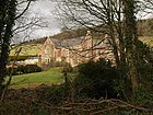
Cothelstone is a village and a civil parish in Somerset in south-west England in the United Kingdom . It is located in the Quantock Hills , about ten kilometers north of Taunton in the Somerset West and Taunton district . The village has 111 inhabitants (as of 2002).
It is said that on days with good visibility you can see Cothelstone from 14 counties and 150 churches with a telescope .
history
The Stawell family received Cothelstone Manor in 1066 from William the Conqueror . During the English Civil War , Sir John Stawell of Cothelstone raised a force at his expense to fight for the king. When Taunton fell into the hands of parliamentary forces and was held by Robert Blake , he attacked and captured Stawell at Bishop's Lydeard . After the Stuart Restoration , King Charles II bestowed the title of Baron Stawell on Sir John's son Ralph.
government
Cothelstone forms a joint parish council with the neighboring parish of Bishops Lydeard . This is responsible for local matters, such as drawing up a budget for the municipalities' expenses and for the accounts. He evaluates building applications and works with the police, county officials and local neighborhood watchdogs on crime and traffic issues. He is also responsible for the maintenance and repair of local roads, sewers, footpaths and street cleaning. The maintenance of trees and protected buildings as well as environmental issues are also the responsibility of the municipal council.
The village belonged to the non-metropolitan district Taunton Deane until the end of March 2019 , which was founded on April 1, 1974 under the provisions of the Local Government Act 1972 , and since then has been part of Somerset West and Taunton . Previously, the place was part of the Rural District Taunton. The district administration is responsible for building permits and roads, social housing, environmental protection, markets and fairs, waste disposal and recycling, cemeteries and funeral services, as well as parks and tourism matters.
Somerset County Council is responsible for the largest and most costly community tasks, such as education, social services, libraries, main roads, public transport, police and fire services, as well as garbage dumping and spatial planning.
Cothelstone falls into the constituency of Taunton , which determines representation in the House of Commons . A member of parliament is elected. At the European level, the place falls in the constituency of South West England , which appoints seven members of the European Parliament , using the D'Hondt procedure .
Buildings
Cothelstone Manor was built in the mid-16th century and largely destroyed by parliamentary troops in 1646. It was not rebuilt until 1855–1856 by EJ Esdaile. The 16th century gatehouse, pavilion, and 17th century Banqueting Hall still exist.
A nearby well house is a grade II * building that was built in the Middle Ages and renewed in the 19th century. It is made of machined red sandstone . Behind the entrance arch there is a shallow basin with clear water, which is also drained through pipes for irrigation. According to tradition, water is said to have healing power and a help in fertility, virgins used prophecies to discover their future husbands on the eve of the feast of St. Agnes . The building is currently being restored.
Religious sites
The Church of St Thomas of Canterbury , also built of red sandstone, dates back to the 12th century. It was largely restored in 1864. It contains tombs of the Stawell family. The Church is by English Heritage as a Grade I classified.
Individual evidence
- ↑ 2002 population estimates ( English ) In: Somerset County Council . Retrieved March 9, 2008.
- ↑ a b Vincent Waite: Portrait of the Quantocks ( English ). Robert Hale, London 1964, ISBN 0709111584 .
- ↑ St Agnes' Well ( English ) In: Images of England . English Heritage. Archived from the original on October 13, 2012. Info: The archive link was automatically inserted and not yet checked. Please check the original and archive link according to the instructions and then remove this notice. Retrieved July 4, 2009.
- ↑ St. Agnes Well - Holy Well or Sacred Spring ( English ) In: The Megalithic Portal . Retrieved July 4, 2009.
- ↑ Holy well based at Cothelstone ( Memento from July 18, 2011 in the Internet Archive ) (English)
- ^ Church of St Thomas of Canterbury ( English ) In: Images of England . Archived from the original on October 4, 2012. Info: The archive link was automatically inserted and not yet checked. Please check the original and archive link according to the instructions and then remove this notice. Retrieved July 3, 2009.
Web links
- Website of the Joint Parish Council (English)
- Cothelstone at Vision of Britain (English)
- Photos of Cothelstone in 3D (anaglyphs) ( Memento from September 9, 2015 in the Internet Archive )


