Crap Sogn Gion
| Crap Sogn Gion | ||
|---|---|---|
|
Crap Sogn Gion |
||
| height | 2263 m above sea level M. | |
| location | Canton of Graubünden , Switzerland | |
| Mountains | Glarus Alps | |
| Coordinates | 735 143 / 188 988 | |
|
|
||
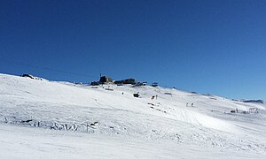
The Crap Sogn Gion ( Rhaeto-Romanic for the stone of St. John ) is a 2263 meter high ridge on the ground of the municipality of Falera in the Swiss canton of Graubünden . Two small rock towers are to the west of the now much more striking mountain station of the cable car, which opened in 1968, and can be seen from the valley. The tourist development began in Laax in 1962 .
Winter sports
The Crap Sogn Gion is part of the Laax ski area and a popular meeting point, especially for snowboarders. In winter, large snow parks with kickers and halfpipes are set up, which makes the place a meeting place for the snowboard and freeskier scene in addition to the actual events .
An installation by the artist Peter Trachsel was set up at Crap Sogn Gion in 1991. It is a black sphere around four meters in diameter, consisting of 1280 triangles in 44 different sizes.
Summit criterion
Strictly speaking, the Crap Sogn Gion does not meet the criterion for being called at least a "summit" ; the first summit with the corresponding 30 meters of independence is located almost 700 meters west of the rock groups on the current map on Crest la Siala , point 2352. The field name is also referred to as " Alpweide" in place name research . Since there is nowhere a sufficiently deep notch , the unnamed peaks in the further course of the ridge as well as the Crap Masegn (2468 m) as well as the Vorab Pign would all be a subsidiary summit of the Vorab , which would be the first independent mountain by definition.
gallery
literature
- Weisse Arena AG (Ed.): The mountain calls. We also. Echoes from the peripheral area . Edition Hochparterre , Zurich 2012, ISBN 978-3-909928-19-4 .
- National map 1: 25,000, sheet 1194 Flims. Federal Office for Topography, Wabern 2016, ISBN 978-3-302-01194-3 .
Web links
- Crap Sogn Gion on the ETHorama platform
- Webcams in the region of Crap Sogn Gion in south direction
Individual evidence
- ↑ Coordinates 46 ° 50 ′ 18.1 ″ N , 9 ° 12 ′ 41.2 ″ E
- ↑ Ortsnames.ch


