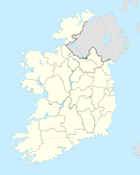
Craughwell (Galway)
| Craughwell Creachmhaoil Craughwell |
||
|---|---|---|
|
|
||
| Coordinates | 53 ° 14 ′ N , 8 ° 44 ′ W | |
| Basic data | ||
| Country | Ireland | |
| Connacht | ||
| county | Galway | |
| ISO 3166-2 | IE-G | |
| Residents | 665 (2011) | |
As Craughwell (formerly: Creaghmoyle , Irish : Creachmhaoil ) (M. m above sea level 62..) Is a village of 665 inhabitants (2011) and the surrounding areas with a total of 1,047 inhabitants (2011) in the County Galway in the province of Connacht in the Republic of Ireland .
Names
The exact origin of the name is unknown.
Possibly the place name comes from the family name Ó Creachmhaoil . The name is in anglicised form as Craughwell and Crockwell in use ( e.g .: Thomas J. Craughwell (author), Gerard Craughwell , (politician) or Douglass Crockwell (painter in the USA)). Outside the south-east of County Galway, the name was largely unknown until the end of the 19th century and was only spread through the emigration of families from Ireland, e.g. B. in Newfoundland , Bermuda , Cornwall , Ohio or Berkshire County in Massachusetts .
Creach is the Irish word for pillage , presumably in relation to herds of cattle, which have often been the target of theft and raids. Ó Creachmhaoil would then be a “grandson of a raiding warrior” or “chief”. According to another variant, creach should refer to craig , creag or the English word crag ( rock or the bare ridge of a hill).
Maol ("bald") was also used in Ireland for a round hill or mountain that is free of trees ( anglicized as mull in English ) and is common in Irish and Scottish place names (e.g. Mull of Kintyre ). -mhaoil would then designate a plural ("pillage hill" or "rocky hill").
The namesake Patrick W. Joyce speculated that the name was originally Creamhchoill , meaning garlic wood , but this is now believed to be incorrect.
geography
The city is on the west coast of Ireland . The village is traversed by the Dunkellin River . The R347 from Athenry to Kinvara crosses the R446 in the village, which leads from Oranmore near Galway to Loughrea . Loughrea is 14 km from Craughwell, 10 km to Athenry and 25 km to Galway. The M6 can only be accessed via Athenry.
The railway line from Limerick via Ennis to Athenry runs through Craughwell.
religion
Craughwell belongs to the Roman Catholic Diocese of Galway and Kilmacduagh , Kilmacduagh Dean's Office .


