Cuchillas del Toa
|
Cuchillas del Toa
|
||
|
View from La Farola to Cuchillas de Toa |
||
| location |
|
|
| surface | 2023.54 km² | |
| WDPA ID | 317045 | |
| Geographical location | 20 ° 23 ' N , 74 ° 42' W | |
|
|
||
| Setup date | 1987 | |
| administration | El Ministerio de Ciencia, Tecnología y Medio Ambiente (CITMA) | |
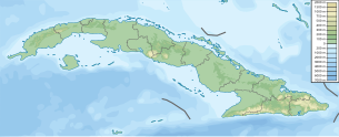
Cuchillas del Toa ( Toa range of hills ) a mountain and marine region of Cuba and as such a biosphere reserve since 1987 .
It is located in the eastern part of the country, mainly in Guantánamo Province , and extends north to Holguín Province . Most of the reserve is located in the catchment area of the Río Toa , which flows into the Atlantic Ocean on the Cuban east coast near Baracoa .
The reserve, which has also been classified as a protected area by the IUCN , extends over 2,083.05 km² of land and sea and surrounds the Alexander von Humboldt National Park .
In Cuchillas del Toa there is also the table mountain El Yunque , with the Salto Fino the largest (300 meters deep) waterfall in the Caribbean and the Great Cave of Moa ( Gran Caverna de Moa ). The karst of the great cave of Moa is one of the five natural monuments in the country and is one of the great cave systems in eastern Cuba.
Flora and fauna
Cuchillas del Toa is one of the main centers of biodiversity and endemism in Cuba due to its changing vegetation with pine forests , cloud forests , thorn bush vegetation , mangroves and coral reefs . 928 endemic plant species are found there; including those of the stone slabs and dragon trees .
In Cuchillas del Toa, among others, live endangered species such as the Cuban ivory-billed woodpecker (Campephilus bairdii), the Cuban Kite , the Cuban Schlitzrüssler and the hawk-like Gundlachsperber ( Accipiter gundlachi ). The Kubatrogon , the hawk-like long-billed harrier ( Chondrohierax uncinatus ) and the blood-spot woodpecker , which also live there, are less endangered .
History and use
In the 18th and 19th centuries , the Maroons found refuge in the region.
In 2002, around 18,300 inhabitants in 498 communities lived in a buffer zone, the transition area of this reserve. They work in forestry and agriculture (coffee, coconut and cocoa), in cattle breeding , in mining ( nickel , chrome , iron and cobalt ) and in ecotourism .
Due to similar environmental conditions and resource management, there is a partnership between the administration of Chuchillas del Toa and that of the Selva Lacandona biosphere reserve in the Mexican state of Chiapas .
See also
Individual evidence
- ^ A b National Protected Areas System of Cuba: Protected Areas . 2005. Accessed on July 9, 2009. ( Page no longer available )
- ↑ a b UNESCO : Cuchillas del Toa . Retrieved March 17, 2008.
- ^ Province of Guantánamo: Provincial Protected Area Network ( es ) 2001. Retrieved October 11, 2007. ( Page no longer available )
- ^ A b Hunt, Nigel: Toa River, the mightiest river in Cuba . 2009. Retrieved October 2, 2009.
- ↑ a b El Gavilán Caguarero (Chondrohierax uncinatus) en las Aves de Cuba ( Spanish ) Guije.com. Retrieved January 18, 2011.
- ↑ Radio Habana: Cuchillas del Toa ( es ) Retrieved October 11, 2007.
- ^ UNESCO - MAB Biosphere Reserves Directory. Retrieved February 22, 2020 .

