
Czarny Potok Gąsienicowy
| Czarny Potok Gąsienicowy | ||
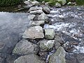
 Czarny Staw Gąsienicowy , source of the river |
||
| Data | ||
| location | Poland | |
| River system | Vistula | |
| Drain over | Sucha Woda Gąsienicowa → Sucha Woda → Biały Dunajec → Dunajec → Vistula → Baltic Sea | |
| source |
Czarny Staw Gąsienicowy 49 ° 13 '45 " N , 19 ° 59' 52" E |
|
| Source height | 1620 m npm | |
| muzzle | to Sucha Woda Gąsienicowa | |
| Mouth height | 1420 m npm | |
| Height difference | 200 m | |
| Bottom slope | 20% | |
| length | 1 km | |
| Communities | Zakopane | |
The Seealmer Schwarzbach ( Polish: Czarny Potok Gąsienicowy ) is an approximately 1 km long right tributary of the Seealmbach ( Sucha Woda Gąsienicowa ) in the Lesser Poland Voivodeship in Poland . It has the character of a high mountain river.
geography
The river has its source in the Polish Green Lake , flows through the valley Czarna Dolina Gąsienicowy and flows into the Seealmbach in the High Tatras . The whole course of the river is in the Tatra National Park .
Surname
The Polish name also means "Schwarzbach" or "Gąsienica-Schwarzbach".
Flora and fauna
The water of the Seealmer Schwarzbach is clean, rainbow trout, trout, grayling, bullhead and minnow live in the river. The river initially flows above the tree line.
tourism
The river is accessible via numerous hiking trails.
River course
Drain

Upper course


literature
- Zofia Radwańska-Paryska, Witold Henryk Paryski, Wielka encyklopedia tatrzańska, Poronin, Wyd. Górskie, 2004, ISBN 83-7104-009-1 .
- Tatry Wysokie słowackie i polskie. Mapa turystyczna 1: 25.000, Warszawa, 2005/06, Polkart ISBN 83-87873-26-8 .