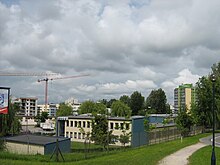
Dąbie (Krakow)
Dąbie is a district of Krakow in Poland , in the II Grzegórzki district , north of the Vistula between Grzegórzki in the west and Czyżyny in the east.
history
The place was first mentioned as Dambe in 1254 when it was owned by the Norbertan women in Zwierzyniec . The topographical name is derived from oak (Polish dąb ).
From the 15th century the city of Krakow took the village with Grzegórzki on lease, but Krakow often sold the village to rich citizens or councilors. In the 17th century there was a brickworks, a sawmill, numerous ponds and a municipal brewery. Politically, the village initially belonged to the Kingdom of Poland (from 1569 in the aristocratic republic of Poland-Lithuania ), Krakow Voivodeship , Proszowice District (later Kraków District).
During the third partition of Poland in 1795, Dąbie became part of the Habsburg Empire . In the years 1815-1846 the village belonged to the Republic of Krakow , in 1846 it was annexed again as part of the Grand Duchy of Krakow to the countries of the Austrian Empire. From 1855 Dąbie belonged to the Kraków District .
In 1900 the community of Dąbie had 340 hectares, 119 houses with 1499 inhabitants, the majority of whom were Roman Catholic (1453) and Polish-speaking (1163). a. 245 German speakers, 77 other languages and 31 Jews.
In 1911 the community with around 1600 inhabitants was incorporated into Krakow. The new part of the city also included a small part of the Rakowice municipality in the north . In 1921, the XX. Dąbie 2307 inhabitants.
In 1931 a vodka factory was founded. On January 15, 1945, 79 people were killed by Germans. In 1961 a barrage was built on the Vistula. At that time, the area was rebuilt with prefabricated housing estates. In 1983 a Roman Catholic parish was established.
Individual evidence
- ^ Tomasz Jurek (editor): DĄBIE ( pl ) In: Słownik Historyczno-Geograficzny Ziem Polskich w Średniowieczu. Edycja elektroniczna . PAN . 2010-2016. Retrieved April 22, 2019.
- ↑ Ludwig Patryn (Ed.): Community encyclopedia of the kingdoms and countries represented in the Reichsrat, edited on the basis of the results of the census of December 31, 1900, XII. Galicia . Vienna 1907 ( online ).
- ↑ Główny Urząd Statystyczny: Skorowidz miejscowości Rzeczypospolitej Polskiej. Województwo krakowskie i Śląsk Cieszyński . Warszawa 1925, p. 17 [PDF: 27] (Polish, Woj.krakowskie i Sląsk Cieszynski miejscowości.pdf ).
Coordinates: 50 ° 4 ′ N , 19 ° 59 ′ E

