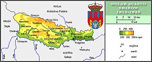
Grand Duchy of Krakow
The Grand Duchy of Krakow ( Polish : Wielkie Księstwo Krakowskie ) came into being when, after the unsuccessful Krakow uprising in 1846, the Republic of Krakow was annexed by Austria on November 16, 1846 . The emperor was thus also Grand Duke of Krakow until 1918.
For administrative purposes, the nominally separate countries Kingdom of Galicia and Lodomeria , Grand Duchy of Krakow, Duchy of Auschwitz and Duchy of Zator (see District of Silesia ) were combined as Kingdom of Galicia and Lodomeria with the Grand Duchy of Krakow and the Duchies of Auschwitz and Zator . From 1849 the Kraków region was the “Kraków District” ( Polish : cyrkuł krakowski ) within Galicia , the “Kraków District” as part of the “Kraków Administrative Region ” from 1850, and the Kraków District from 1867 (in the east; 1910: 64 municipalities, 68,827 inhabitants ) and Chrzanów district (in the west; 1910: 88 municipalities, 110,838 inhabitants).
Initially there were four cities: Kraków, Chrzanów , Trzebinia and Nowa Góra . In 1901 Jaworzno was promoted to town.
In 1847/48 the Kraków-Upper Silesian Railway (also called the Myslowitzer Railway ), the first railway in Galicia, was opened.
See also
literature
- Alfred Regele: The incorporation of the Free State of Krakow in 1846. Unprinted dissertation, Vienna 1951.
- Christian Ortner : The uprising in Cracow and Western Galicia of 1846. In: Heeresgeschichtliches Museum Wien (Ed.): From mercenary armies to UN troops. Armies and wars in Austria and Poland from the 17th to the 20th century. Vienna 2011, ISBN 978-3-902551-22-1 .

